07 Oct 2026
The urgent case for governing hills and rivers together in the Northeast of India with an integrated approach.
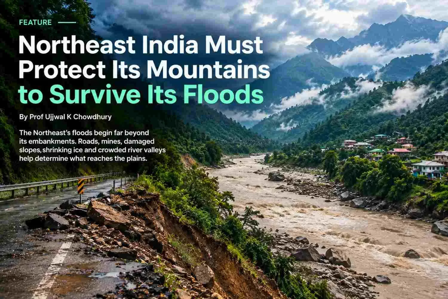
The Northeast's floods begin far beyond its embankments. Roads, mines, damaged slopes, shrinking ice and crowded river valleys help determine what reaches the plains. The enormous Siang proposal now demands a harder question: will it reduce the region's combined risks, or redistribute them?
Summary Northeast India needs to manage mountains, rivers and settlements as one connected system. The 2026 flood debate, new developments around the proposed Siang project and Nepal's recent catastrophe make that task urgent. Stronger embankments and reservoirs can protect particular places, but their benefits depend on location, maintenance, operating rules and the hazards they can actually withstand. Governments must also restore flood storage, regulate extraction and hill cutting, protect Indigenous rights, and make warnings trigger action across borders. The practical agenda begins before the 2027 monsoon and extends through 2031, with public measures of safety rather than construction expenditure alone.
The next flood may begin above the clouds
The next devastating flood in Assam may begin on a hillside where a road contractor leaves loose debris, in a rain-soaked catchment in Nagaland, or in a high Himalayan valley where rock and ice suddenly give way. By the time the danger appears beside a downstream home, decisions taken years earlier and hundreds of kilometres away may already have helped determine its force.
For the family trying to save its cattle, documents and children, these distinctions offer little comfort. Yet they are essential to preventing the next loss. A breached embankment is the visible failure. The chain that brought water and sediment to it is the larger story.
The three recent Counterview articles identify complementary failures: Assam's excessive dependence on embankments, inconsistent treatment of Himalayan fragility, and flood governance divided by state boundaries. Together, they point towards a regional approach that follows the river upstream into the mountains and downstream into livelihoods. [1–3]
That approach now faces a consequential test on the Siang in Arunachal Pradesh. India is considering an immense multipurpose storage project partly as protection against upstream risks from China. The strategic concern deserves serious examination. So does the possibility that protecting against one danger could introduce another through excavation, reservoir slopes, displacement or operating decisions.
The Northeast needs development that remains useful when conditions become dangerous. That requires treating the stability of a mountain and the safety of a floodplain as connected public responsibilities.
Floodwater carries a piece of the mountain
An ordinary-looking brown river contains evidence of what has happened uphill. Its load can include naturally eroded soil and rock, material loosened by construction, and sediment remobilised from earlier floods. Under exceptional conditions, that load becomes boulders, uprooted trees and a rapidly moving debris flow.
Heavy rain can saturate a slope and increase pressure within its soil or fractured rock. Failure may dump material into a channel. If the material blocks the river, water accumulates behind a temporary natural dam. When that blockage breaks, the flood can arrive after the rain has weakened or stopped. Watching today's rainfall alone will miss part of tomorrow's danger.
Downstream, deposited sediment can reduce the space available to carry water in particular reaches, redirect channels, or obstruct tributary outlets. Elsewhere, intense scouring deepens the bed and undermines bridges or banks. The Brahmaputra does not respond uniformly along its length. An explanation that says every embankment invariably raises every riverbed is too simple for this changing system. [5]
Nor can every upstream landslide be blamed on human activity. Natural geology, earthquakes, rainfall and river erosion are powerful forces. The policy question is where human interventions add avoidable instability or exposure, and whether those additions have been measured.
This creates a clear connection between two administrative files usually handled separately. Slope management determines part of what enters a river. River management determines where that material and water go. A hillside's construction waste can become a downstream village's excavation bill, lost harvest or shattered bridge.
Eight states need more than one flood formula
The Northeast is not a single Himalayan valley. A programme designed around glaciers would miss much of its danger, while an Assam embankment programme would miss the instability of its uplands.
Arunachal Pradesh connects high mountain hazards and steep catchments to the Siang, Subansiri, Dibang, Lohit and other rivers. Its priorities include slope stability, sediment, hydropower operations and the survival of roads that serve isolated settlements. Assam receives these flows while facing its own rainfall, drainage congestion, erosion and shifting channels. The Brahmaputra and Barak valleys need distinct plans within a coordinated regional system.
Nagaland's connections to Upper Assam through the Dikhow, Disang and Dhansiri illustrate why small tributaries deserve attention equal to the main river. The July 2026 accounts describe rainfall in the Naga Hills producing damaging downstream surges. That is a reason for joint investigation and warnings, rather than a licence to assign collective blame to another state's people. [3,5]
Meghalaya's steep catchments, expanding settlements and extraction pressures require careful management of runoff, drains and disturbed slopes. Mizoram and Nagaland need road designs that protect hillsides and keep settlements accessible. Manipur requires separate attention to the Barak headwaters and the drainage of the Imphal valley. Loktak's ecological health and the functioning of connected waterways belong in that valley's planning.
Tripura's Gomati, Manu, Khowai and Feni systems require basin-specific rainfall warnings, reservoir coordination where relevant, and links with Bangladesh. Sikkim's Teesta demonstrates the reach of glacier-related hazards beyond the mountains, through West Bengal and into Bangladesh. These geographical connections are practical units for planning; they cannot be replaced by a general declaration that the entire Northeast has the same risk. [19,20]
Within each state, the distinction must become still finer. A slow, shallow inundation of agricultural land, an eroding riverbank and a boulder-rich mountain surge call for different decisions. A stilt house may be appropriate for the first; secure relocation may be essential for the other two.
Climate is changing the design conditions
The monsoon's apparent contradiction matters: a seasonal rainfall deficit can coexist with destructive local floods. A monthly average does not describe how rapidly rain fell, how saturated the ground was, or which upstream catchment received it. A relatively dry fortnight followed by an intense downpour can produce both agricultural stress and flood damage. [5]
The IPCC assesses growing risks associated with heavy precipitation, glacier retreat and changing mountain stability. That is a reason to update design assumptions. It does not establish climate change as the exclusive cause of each landslide, or prove that every Northeast district will experience the same trend. [6]
ISRO's 2024 satellite assessment offers a similarly important distinction. Of 2,431 glacial lakes larger than ten hectares identified in 2016–17 across the studied Himalayan catchments, 676 had expanded since 1984; 601 of those expanding lakes had more than doubled. Expansion warrants assessment, but is not an announcement that all these lakes will burst. Location, dam material, surrounding slopes and downstream exposure matter. [8]
The lesson for Arunachal and Sikkim is to watch the surrounding mountain as well as the lake. For the non-glaciated hills farther south, the relevant questions concern intense rainfall, weathered slopes, drainage and land use. Both tasks need observations that are updated as conditions change.
Embankments need an escape route for water
Embankments can protect settlements, crops and essential infrastructure. Their continued use should depend on a clear answer to three questions: what are they protecting, against what event, and what happens when their intended level of protection is exceeded?
A bank that keeps river water out may also trap local rainfall inside. A road embankment can interrupt drainage across a floodplain. Protecting one reach can change water levels or erosion elsewhere. These effects require connected modelling and maintained outlets, not an assumption that a taller wall automatically makes everyone safer. [1,5]
The alternative is a carefully chosen combination. Retain and maintain essential defences. Where land and compensation arrangements permit, move selected embankments back, reconnect flood-storage areas and allow rivers more space. Protect beels and other wetlands together with the channels that feed and drain them. Assess proposed interventions for their effects on neighbouring villages before construction.
Seasonal flooding also supports wetland ecology. Kaziranga illustrates the need to distinguish beneficial inundation from dangerous depths, prolonged submergence and blocked wildlife movement. Safe passage towards higher ground and traffic management belong alongside human evacuation planning. [1]
Nature-based measures have limits. Wetlands can fill; forests cannot absorb an unlimited deluge. Their value lies in reducing particular risks and preserving ecological functions, combined with appropriate engineering and evacuation. Restoring a beel while blocking its outlet with a new development would defeat the investment.
The quarry bill arrives downstream
The misuse of natural resources often begins with a transaction that looks locally profitable. A hillside supplies aggregate. A river supplies sand. A forest becomes a construction site. The resulting public cost may emerge much later, in another district's flood losses.
Road cuts can remove support from slopes, while badly placed drains concentrate runoff onto unstable ground. Spoil tipped into gullies adds material ready to be carried away. Unscientific mining can disturb slopes and waterways. Excessive riverbed extraction can alter channel shape and undermine banks or bridge foundations. These mechanisms require site-specific investigation; they should not become an accusation that any one activity explains an entire flood. [2,4,5]
Nor should conservation become a convenient way to blame Indigenous farmers while ignoring large contractors and commercial extraction. Customary farming systems vary. Their effects depend on practices, fallow periods, slope conditions and changing economic pressures. Regulation must examine actual disturbance and offer viable livelihoods, rather than treat community identity as an environmental offence.
For governments, the immediate requirement is traceability. Every major excavation should have an approved spoil destination, drainage design, restoration obligation and independently checked record of where material went. Mining permissions should reflect channel change and cumulative extraction, with inspections after major floods. Contract payments should depend on these obligations being met.
Dredging needs the same discipline. Removing a shoal may help a specific obstruction, but a sediment-rich river can refill an excavated reach. Indiscriminate dredging can also shift erosion. Decisions must follow a sediment budget showing where material originates, accumulates and travels, rather than a promise to dig the flood away.
Siang has reached a consequential decision point
The Siang Upper Multipurpose Project, often called SUMP, remains a proposal whose design is being investigated. NHPC's 2023–24 annual report listed three alternatives: Uggeng at 11,600 MW, and Dite Dime and Parong at 11,200 MW. Those figures represent potential electricity-generating capacity, not an independently demonstrated flood-protection benefit. [9]
The Arunachal Cabinet approved a high-level committee to oversee preliminary feasibility survey activities in September 2026. On 29 September, Chief Minister Pema Khandu said advancement would depend on technical feasibility, with further social and environmental assessments and a detailed project report if the proposal progressed. The investigations would address construction in Seismic Zone V and protection against possible upstream releases. He described the intended study period as November through January. Earlier alternative studies therefore should not be confused with a final, approved design. [10,11]
The attraction is understandable. A large reservoir could provide electricity, revenue and some ability to regulate incoming water. The government also presents the scheme as a strategic response to upstream developments in China.
But Arunachal's potential benefits and Assam's potential protection must be examined separately. An electricity project can earn revenue without protecting every downstream community. A structure on the Siang cannot intercept a flood generated in Nagaland's tributaries, the Barak basin or Guwahati's drains. Its geographical limits should appear prominently in every public claim.
Flood protection depends on empty space and operating rules
A reservoir moderates a flood when it can temporarily hold some incoming water and release it more slowly. Its effectiveness depends on available storage at the moment of arrival, the duration and size of the flood, outlet capacity and conditions downstream. Installed megawatts tell us none of those things.
This creates an operating trade-off. Storing water supports electricity generation and dry-season supply; retaining empty space supports flood absorption. Forecasts can help reconcile the two, but cannot remove uncertainty. A seasonally prescribed rule curve, which sets intended reservoir levels over the year, must therefore be backed by enforceable responsibilities and decisions tested against difficult conditions. [22]
For Siang, a public appraisal should answer four practical questions. How much usable flood storage would remain during different parts of the monsoon? Which upstream events could the project moderate, and which would exceed its capacity? What downstream consequences would follow from planned releases or emergency operations? How would those conclusions change as sediment accumulates and rainfall patterns shift?
The tests should include an upstream landslide-dam outburst arriving when the reservoir is already high, intense rain in tributaries below the dam, blocked gates, power loss and disrupted communications. Scenarios should state their probabilities where these can be estimated and identify the uncertainty where they cannot.
Protection against a flood wave is also different from compensation for reduced upstream flows. A reservoir can redistribute water already received; it cannot manufacture a continuing supply. Its contribution to dry-season security must be calculated against plausible inflows, demand and losses. Political assurances should not substitute for those calculations.
Sediment will decide how long protection lasts
A dam holds back a proportion of the sediment arriving with the river. Deposits occupy space intended for water, so a flood-storage assessment must show how useful capacity changes over decades. It must also examine damage to equipment and obstruction of outlets during exceptional sediment pulses. The Central Water Commission already has a handbook for assessing and managing this problem. [29]
Below the reservoir, altered water and sediment flows can change erosion, deposition and river habitat. Tributaries may replenish some sediment farther downstream, so the response will differ by reach. It would be misleading to promise uniform benefit from trapping silt, or predict uniform damage throughout Assam. Siang needs its own connected measurements and modelling. [30]
The timing of water matters too. Rapid release changes for power generation can affect people using the channel and the ecology of the river. An operating plan should examine seasonal flows, acceptable rates of change, and warnings for downstream users, alongside any minimum-flow requirement.
Flood protection must therefore be assessed across the project's lifetime. The appraisal should specify monitoring, sediment-management options and the costs of keeping them effective. A reservoir cannot be advertised with the storage capacity of its opening year while later generations inherit the consequences of accumulated material.
A strong dam can still sit inside an unsafe valley
The safety of the dam wall is only one part of the assessment. Construction brings access roads, excavation, tunnels, quarries, spoil sites, worker camps and transmission corridors. Each creates a footprint that can affect slopes, drainage and exposure. [2,4]
A future reservoir would also require close assessment of its surrounding slopes. Changing water levels can change groundwater pressure and the support provided to saturated material. A large slide into water may generate a displacement wave. Seismic loading, reservoir-related seismicity where relevant, and the stability of abutments and rim slopes need site-specific investigation. None of these possibilities proves that the proposed Siang project will fail; each identifies a question that its safety case must answer. [27]
The cumulative test should consider nearby infrastructure and the construction period itself. A completed plant may have monitored slopes while temporary works, camps and access roads remain exposed. A disaster can arrive before commissioning.
Arunachal should require baseline measurements before major disturbance, monitoring through excavation and filling, published intervention thresholds, and independent authority to stop unsafe work. Developers should fund these responsibilities over the project's life, including emergency planning and eventual closure.
This is also an energy-security issue. Placing generation, access and transmission in a shared hazard corridor can create simultaneous failures. Alternatives should include lower-impact project configurations, energy efficiency, distributed supply for isolated settlements and broader grid options. Smaller hydropower deserves assessment too; a small project in a dangerous channel can still be unsafe.
Sikkim and Nepal reveal how disasters grow
Sikkim has already experienced a mountain-to-river catastrophe. A 2025 Science study reconstructed the October 2023 South Lhonak event: collapsing frozen moraine entered the lake, produced a large impact wave and released roughly 50 million cubic metres of water. The flood then eroded about 270 million cubic metres of sediment along its path and overwhelmed infrastructure, including hydropower installations. Those estimates describe successive processes, not a simple water-to-mud mixing ratio. [15]
Its lesson for Siang is the growth of a hazard as it moves. Designs need to examine debris, erosion and connected failures, rather than assume that the initiating water volume remains the whole event downstream.
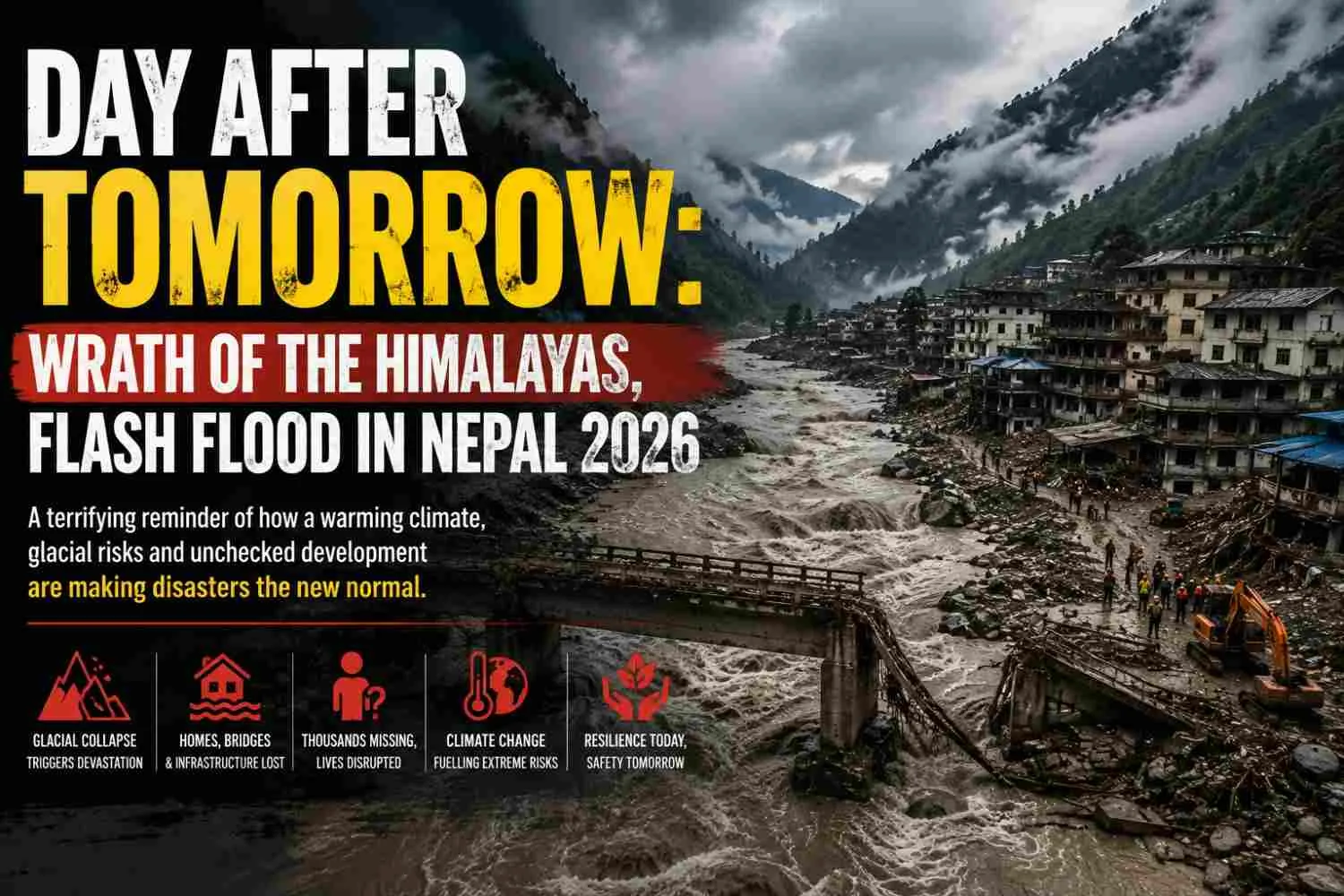
Nepal's 26 August 2026 Rasuwa-Gyirong disaster adds another warning. ICIMOD's evolving assessment describes an ice-rock avalanche entering the Lhende corridor and transforming into a debris flow. The precise timing and possible temporary river blockage remain under scientific examination. It was not simply a conventional outburst from a known glacial lake. Direct attribution of this particular event to warming also remains unresolved. [16]
Nepal's experience also shows how concentrated roads, power infrastructure, settlements and local institutions can turn one valley's destruction into a wider systems crisis. Lessons on safer relocation, redundant communications and inclusion of landless families are directly relevant to the Northeast. A village needs functioning government and access after a flood, as well as a surviving house. [4]
On 25 September, ICIMOD published the Kathmandu 10 Action Points, calling for stronger monitoring, faster cross-border information, better response capacity and people-centred recovery. Northeast governments can turn that recent regional agenda into district operations before another monsoon. [17]
China raises a real concern that needs real evidence
China announced the start of construction of its lower Yarlung Zangbo hydropower project on 19 July 2025. The official account described five cascade stations and investment of around 1.2 trillion yuan. The river subsequently enters Arunachal as the Siang and contributes to the Brahmaputra system. [12]
On 23 July, China's foreign ministry stated that the project would not adversely affect downstream areas and would support disaster prevention. That is Beijing's stated position, not an independently verified finding about every future operating condition. Indian strategic concerns likewise need to be separated from demonstrated project-specific consequences. [13]
Upstream instability is already a scientific concern. Research on the Sedongpu catchment documents glacier-related cascades that blocked the Yarlung Tsangpo in 2018. The danger from natural mountain failure therefore exists alongside questions about dams. A comprehensive warning system has to observe both. [14]
India should seek agreed procedures for reservoir filling, planned and emergency releases, abnormal river blockage and rapid downstream alerts. China, India and Bangladesh need arrangements that remain functional during political tension. Bhutan is equally important to coordination in the river systems it shares with Assam.
If India demands transparent assessment upstream, it should offer comparable scrutiny to communities downstream of its own projects. Applying the same safety principles to China, Nepal and Arunachal would strengthen India's case. Competitive dam building without shared information could leave the basin with more infrastructure and continuing uncertainty.
Consent belongs inside the safety assessment
For Adi communities, the Siang valley is a place of land, food, kinship, cultural memory and customary authority. Tadu Rimi's March 2026 research describes these connections and the role of traditional councils in opposition to the project. The implications extend beyond compensation for a house or field. [18]
Some local people see opportunity in development; others fear profound loss. A credible process must hear both without treating one group as the authentic community and the other as an inconvenience. Consultation should begin early enough to affect the choice of site, scale and alternatives.
Villagers need accessible maps of likely submergence and hazards, independent advice, records of questions and answers, and clear distinctions between agreement to investigations and agreement to construction. Customary institutions, women, young people, tenants and households without conventional title documents need meaningful participation. Applicable land, forest, environmental and rehabilitation obligations remain part of the decision.
This also improves the evidence. Residents can identify flood marks, past slope movement, springs, seasonal channels and routes that outsiders overlook. That knowledge should be tested alongside geological investigation and modelling.
Assam's downstream residents need a voice too. Benefits and risks cross the state boundary. A project appraisal that listens near the proposed reservoir while overlooking those exposed to releases or changed sediment downstream would leave an important part of its social assessment unfinished.
Existing policy needs consequences on the ground
India already has institutions and tools for this work. The Brahmaputra Board's statutory remit includes basin planning for floods, erosion and drainage. In June 2026, it reviewed work on 15 sub-basins and sediment studies in the Siang and Dibang being undertaken by IIT Guwahati. The starting point is to make those studies influence approvals, budgets and operating decisions. [19,20]
Four limitations need attention. First, assessments can remain fragmented between project sites, sectors and states. Cumulative analysis must test interacting hazards and infrastructure, with a clear requirement to change or refuse a proposal when risks are unacceptable.
Second, mapped danger does not necessarily change land-use permission. National floodplain-zoning technical guidance was circulated in August 2025. States must translate such guidance into notified boundaries, development controls, appeal procedures and funded arrangements for affected households. A map without enforceable decisions offers little protection. [21]
Third, ecological protection and flood planning can leave gaps between categories. The Wetlands Rules' definition excludes river channels; wetland notification alone therefore cannot protect every route that carries or stores floodwater. State planning must also safeguard connected drains, seasonal waterways and flood corridors through appropriate legal instruments. [26]
Fourth, responsibility for long-term maintenance and emergency decisions needs to be unambiguous. The Dam Safety Act framework and subsequent directions address rule curves, information exchange and coordinated cascade operations. Governments must verify that these obligations result in working communication and drills, rather than assume formal compliance guarantees downstream safety. [22]
The same accountability should apply to roads, embankments and spoil disposal. Ministries promoting projects need independent scrutiny of safety conclusions, and affected people need an accessible way to challenge failures.
A warning matters when someone can act on it
The Northeast has a base to build upon. NESAC's Flood Early Warning System combines rainfall prediction, hydrological modelling and geospatial information to issue actionable Assam advisories. Its historical lead times cannot guarantee warning for every sudden mountain event. [23]
Radar satellite imagery can map inundation through cloud, while river gauges, rainfall instruments and weather forecasts help estimate what may arrive next. These are different functions. A flood map does not by itself predict the next collapse. ISRO's Landslide Atlas provides a valuable historical inventory, but new disturbances and evolving slopes require continuing observation. [7]
Technology should be joined to local decisions. A dangerous threshold needs an identified official authorised to issue evacuation instructions, a tested message in locally understood languages, and a way to reach people without phones or mobile coverage. Sirens, radio, community volunteers and backup communications need regular exercises.
For a steep headwater village, there may be only minutes to move. Farther downstream, useful warning may be much longer. Plans must show realistic travel times, accessible shelters, transport for people who cannot evacuate unaided, and safe arrangements for livestock. Hospitals, schools and worker camps need their own procedures.
Every major event should then be reviewed publicly: when danger was detected, when the warning was sent, who received it, and what prevented action. Forecast skill and successful evacuation are related achievements, but they should be measured separately.
New finance must buy a reduction in risk
Assam's investment programmes already reach beyond conventional flood walls. The World Bank's $108 million project approved in 2023 includes forecasting, shelters, emergency capacity and green infrastructure. In February 2026, ADB approved $182 million in additional financing alongside its existing $200 million programme, with wetland restoration and livelihood measures among the planned activities. [24,25]
Loan approval is an opportunity, not proof that protection has been delivered. Public reporting should distinguish approved finance, disbursement, completed works and outcomes. It should show whether warning reaches improved, repeated displacement declined and restored drainage functioned during heavy rain.
Rescue and compensation remain essential. But annual maintenance, competent technical staff, local preparedness and the correction of unsafe land use need predictable funding too. A government should not have to wait for a disaster declaration to repair a known dangerous outlet.
Dedicated State and National Disaster Mitigation Funds already provide a route for eligible prevention investments. Northeast finance departments should connect these opportunities to district risk priorities, while securing ordinary budget support for staff, instrument upkeep and maintenance. Gauges installed without funding for their operation can produce an expensive silence. [28]
There is also a fairer way to connect upstream and downstream interests. Assam and neighbouring hill states could negotiate co-financing for verified catchment restoration, safe spoil management and community monitoring. Such agreements should pay for measurable stewardship and recognise local land rights. They should not promise that a restored forest can prevent every extreme flood. Sharing the cost of prevention would give cooperation a practical economic basis, rather than leaving one state to defend its development and another to count the losses.
The short run begins before the 2027 monsoon
The following measures are a proposed agenda for Northeast governments over the next twelve months, beginning in October 2026. They require cooperation with Union agencies and dam operators where powers are shared.
In the first ninety days, identify the places where delay is dangerous. State disaster authorities should commission joint district inspections of critical embankments, blocked flood outlets, unstable road cuts, spoil sites, vulnerable bridges and exposed public facilities. Publish each finding with an owner, deadline and interim safety measure. Local observations should help select sites, while qualified engineers verify the risks.
Put basin agreements ahead of the next emergency. Assam and Nagaland should begin with the Dikhow, Disang and Dhansiri catchments; Assam and Arunachal should establish comparable protocols for their shared tributaries. Other states should organise their own connected basins. Agree how gauges, rainfall alerts, reservoir information and temporary channel blockages reach downstream control rooms, and test the communication chain before the monsoon.
Keep irreversible Siang decisions behind evidence. Arunachal and the Union government should publish the scope, alternatives and review process for the current feasibility work. Establish an independent multidisciplinary review, fund community access to advice, and require public responses to major objections. Survey participation must not be represented as construction consent. Decisions about construction should follow the necessary assessments and clearances.
Protect drainage while long-term zoning is prepared. Planning, revenue and municipal authorities should prevent new obstruction of mapped high-risk waterways and investigate unsafe excavation. Interim restrictions need lawful notice, transparent review and support for affected occupants. Repair drainage, stabilise priority slopes and secure spoil; avoid hurried works that transfer risk to another location.
Make evacuation and relief usable for every household. Before the 2027 rains, districts should run exercises with schools, health facilities, work camps and riverine communities. Pre-position safe water, sanitation, medicines and boats. Include disability access, menstrual hygiene, child protection, replacement documents, livestock and rapid livelihood assistance. Relocation support must recognise tenants and people whose land has disappeared through erosion.
The first-year public dashboard should track repairs completed, gauges functioning, warnings received in drills, evacuation times and grievance resolution. These measures make readiness visible before a flood supplies the test.
The middle run must change where and how development happens
Over one to five years, broadly 2027–2031, governments should use those first measures to change the underlying pattern of exposure.
Make flood and slope zoning enforceable and affordable. Each state should connect updated hazard maps to building permission, public infrastructure location and land records. Secure replacement land, transitional rent and livelihood support must accompany movement from places where safe habitation cannot reasonably be maintained. Relocate functioning communities with schools, health care and cultural continuity; do not recreate exposure on the nearest cheap terrace.
Require development to pass a basin test. Arunachal and Sikkim should assess hydropower and associated construction alongside roads, transmission and settlements in each connected valley. Nagaland, Meghalaya and Mizoram should prioritise cumulative slope and extraction pressures. Assam should assess downstream flow, erosion and drainage consequences. Manipur and Tripura need plans adapted to their valley and cross-border river systems. Decision rules must allow redesign, relocation or refusal, with reasons made public.
Restore the places that hold and safely convey water. Assam's beels and urban drainage networks deserve sustained programmes. Manipur should integrate valley drainage with Loktak management; Tripura should protect storage and conveyance in its catchments. Test selected embankment setbacks and flood-storage restoration with landholders, compensate agreed losses, and monitor performance. Upland states should restore native vegetation and springsheds where suitable, with paid community stewardship.
Build a permanent regional technical capability. Strengthen the Brahmaputra Board and state agencies with geologists, hydrologists, ecologists and trained field staff. Support open data and independent analysis through institutions such as IIT Guwahati, universities and NESAC. The regional compact should have funded basin teams and annual public reviews. Avoid creating another committee whose responsibilities end at recommending that another committee act.
Price lifetime risk and negotiate across borders. Project appraisals should include maintenance, sediment, rehabilitation, emergency arrangements and plausible disruption. Contractor obligations and developer reserves should cover environmental restoration and safety over time. States and the Union should pursue practical data and emergency agreements with China, Bhutan and Bangladesh, using Nepal's recent experience to strengthen regional cooperation. Share decision-ready alerts that explain the danger and required action.
By 2031, progress should be assessed through reduced repeated displacement, safer infrastructure, effective warning coverage and restored water storage, accounting for differences in rainfall between years. Construction totals alone cannot show whether risk has declined.
For a child beside an Assam river or an Arunachal slope, success is concrete: a home in a safer place, a school that remains reachable, and a warning the family can use. The Siang decision should be judged within that wider promise. The Northeast's mountains and floodplains need a development policy that protects the people connected by them.
Sources and further reading
Sources accessed or checked on 4 October 2026. Numbers in the text identify supporting research, official statements or supplied articles. Project proposals and government assurances are distinguished from demonstrated outcomes; recommendations are the author's policy proposals.
[1] Yadappanavar, A. V. (4 October 2026). Beyond embankments: Why Assam's 2026 floods demand a paradigm shift in India's disaster management. Counterview. Open source
[2] Sharma, Kvita (4 October 2026). If Nepal's mountains are fragile, so are Arunachal's. Counterview. Open source
[3] Yadappanavar, A. V. (4 October 2026). When rivers ignore state boundaries: Rethinking flood management in northeast India. Counterview. Open source
[4] Chowdhury, U. K. When the Mountain Fell into the River. Supplied article in NepCrisisFinal(3).docx; evidence cut-off 30 August 2026.
[5] Chowdhury, U. K. Too Much Water, Yet Not Enough Rain: India's Monsoon Emergency of 2026. Supplied article in MonSoonFin.docx.
[6] IPCC (2022). Cross-Chapter Paper 5: Mountains. Climate Change 2022: Impacts, Adaptation and Vulnerability. Open source
[7] ISRO / NRSC (18 March 2023). Landslide Atlas of India. Open source
[8] ISRO (22 April 2024). Satellite Insights: Expanding Glacial Lakes in the Indian Himalayas. Open source
[9] NHPC (2024). Annual Report 2023–24, section 9.3 on Upper Siang Multipurpose Storage Project. Alternative capacities and geological investigations. Open source
[10] Tayeng, M. (29 September 2026). Siang project will move ahead only if feasibility study gives green signal: Arunachal CM. India Today NE. Open source
[11] The Economic Times (23 September 2026). Arunachal Cabinet forms panel to oversee Upper Siang project survey. Open source
[12] Xinhua (19 July 2025). Chinese premier announces construction of Yarlung Zangbo hydropower project. Open source
[13] Xinhua (23 July 2025). China's Yarlung Zangbo hydropower project has no adverse impact on downstream areas: spokesperson. Official position. Open source
[14] Li, Y., Cui, Y., Hu, X., and colleagues (2024). Glacier Retreat in Eastern Himalaya Drives Catastrophic Glacier Hazard Chain. Geophysical Research Letters, 51, e2024GL108202. Open source
[15] Sattar, A., Cook, K. L., Rai, S. K., and colleagues (2025). The Sikkim flood of October 2023: Drivers, causes, and impacts of a multihazard cascade. Science, 387, eads2659. Open source
[16] ICIMOD (2026). Kyirong-Rasuwa Flood 2026: Nepal-China Cryosphere Risk. Evolving assessment and distinctions between avalanche, debris flow and GLOF. Open source
[17] ICIMOD (25 September 2026). Kathmandu 10 Action Points: HKH countries chart a path to better preparedness after catastrophic Rasuwa-Gyirong flood. Open source
[18] Rimi, T. (March 2026). Local Response to National Projects: The Siang Hydropower Project in Arunachal Pradesh. Centre of Excellence for Himalayan Studies, issue 30. Open source
[19] Government of India (1980). The Brahmaputra Board Act, 1980. Statutory basin-planning mandate. Open source
[20] Ministry of Jal Shakti / PIB (19 June 2026). Brahmaputra Board Reviews Flood Management, River Basin Planning and Sustainable Development Initiatives in North East. Open source
[21] Ministry of Jal Shakti / PIB (4 December 2025). Filling of Posts in National Dam Safety Authority. Parliamentary reply also records circulation of floodplain-zoning guidance in August 2025. Open source
[22] Ministry of Jal Shakti / PIB (1 December 2025). Floods in Punjab and Poor Reservoir Management at Dams. Parliamentary reply on rule curves, hydrological data and coordinated cascade operations. Open source
[23] North Eastern Space Applications Centre (undated). Disaster Management Support: Flood Early Warning Systems. Historical operational description. Open source
[24] World Bank (24 March 2023). World Bank Approves $108 Million to Improve Disaster Preparedness for Flood-prone Districts of Assam. Open source
[25] Asian Development Bank (10 February 2026). ADB Approves $182 Million Loan to Scale Up Flood and Erosion Management Along Brahmaputra in Assam. Open source
[26] Tamil Nadu State Wetlands Authority (undated). Tamil Nadu Wetlands Mission. Reproduces the definition under the Wetlands (Conservation and Management) Rules, 2017. Open source
[27] Central Water Commission (June 2017). Guidelines for Safety Inspection of Dams. Includes reservoir-rim and slope inspection considerations. Open source
[28] Ministry of Home Affairs, Disaster Management Division (current official information). Response Fund: State and National Disaster Mitigation Funds. Open source
[29] Central Water Commission (February 2019). Handbook for Assessing and Managing Reservoir Sedimentation. Open source
[30] Collier, M., Webb, R. H., and Schmidt, J. C. (1996, revised 2000). Dams and Rivers: A Primer on the Downstream Effects of Dams. USGS Circular 1126. Open source
#NortheastIndia #Siang #Brahmaputra #FloodResilience #HimalayanSafety #ArunachalPradesh #ClimateJustice #RiverBasinManagement
...Read more