Total Articles 231+

India

India is a diverse and culturally rich country located in South Asia, known for its ancient history, vibrant traditions, and rapidly growing economy. This category covers everything related to India, including its geography, culture, heritage, politics, technology, lifestyle, and current developments.

Showing 12/52

14 Oct 2026

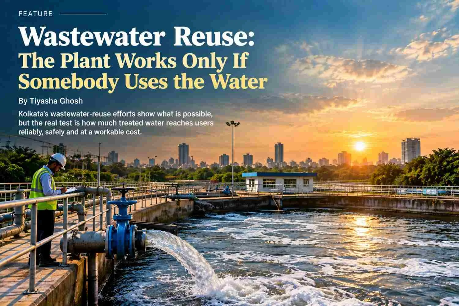
14 October 2026 | Kolkata, West Bengal Kolkata’s wastewater-reuse efforts show what is possible, but the real test is how much treated water reaches users reliably, safely and at a workable cost. Summary: Treated wastewater can reduce pressure on freshwater supplies, but a treatment plant’s capacity does not prove that its water is being reused. Public records point to reuse in Kolkata’s Sector V and the East Kolkata Wetlands, while gaps in published data make it difficult to assess actual volumes, costs and reliability. As West Bengal moves towards its 2030 reuse target, the question is whether the water is reaching users and delivering measurable benefits. If a City Can Treat Wastewater, What Stops It from Reusing More of It? A wastewater treatment plant may appear to offer a practical solution to water scarcity. It collects sewage, treats it and produces water that can be used for certain non-drinking purposes. But treatment is only one part of the process. What happens afterwards matters just as much. Does the treated water reach an actual user? Does it meet the required quality standards? Can the supply remain reliable without making the water too expensive? These questions are central to Kolkata’s water-security challenge. Reusing treated wastewater can reduce dependence on freshwater, but only when treatment, distribution and actual use work together. What Do Kolkata’s Records Reveal? One documented example comes from Sector V in Salt Lake, where the Nabadiganta Industrial Township Authority (NDITA) manages water and civic services. A report published by The Times of India on 13 November 2025 stated that treated wastewater from Sector V’s sewage treatment plants was being reused for gardening and road washing. The report also noted that NDITA received close to three million gallons of filtered water daily from Tala to supply the township. These are two separate water streams. The filtered water supplied from Tala should not be confused with the treated wastewater reused locally. The example establishes that treated-water reuse has been reported in a real urban setting. However, the publicly available report does not specify the daily volume of wastewater reused, its operating cost, the energy required for treatment and distribution, or the latest laboratory results. It therefore cannot, on its own, establish how efficiently the system operates or how much freshwater it saves. The wider picture in Kolkata is more complex. A Kolkata Municipal Corporation progress report for August 2025, submitted in a matter related to the National Green Tribunal, estimated that the city generated around 1,400 million litres of sewage per day (MLD). It reported that approximately 910 MLD received natural treatment through the East Kolkata Wetlands and was used for activities including pisciculture, mixed farming and animal husbandry. The report also listed five operational sewage treatment plants with a combined capacity of 179 MLD, while provisions for reusing their treated water were still under consideration. Kolkata’s District Environment Plan for 2025–26 also recorded 910 MLD associated with the East Kolkata Wetlands, 179 MLD of capacity across five existing treatment plants, and 311 MLD of untreated or partially treated sewage. These figures describe different parts of the city’s sewage system. They should not be interpreted as a current measurement of how much treated water is actually being reused by end users. The East Kolkata Wetlands are an important part of this story. They support fisheries and other livelihoods while naturally treating wastewater. However, this process is not identical to a conventional treatment plant supplying reclaimed water through a controlled distribution system. Both approaches have a role to play, but each must be assessed according to its own water-quality, environmental and operational requirements. West Bengal’s 2030 Target Raises the Stakes On 14 July 2026, West Bengal notified its State Policy on Safe Reuse of Treated Wastewater. The policy sets a target for at least 20% of the state’s overall industrial water requirement to be met through municipal wastewater by 2030. It also promotes reuse for non-drinking purposes in eligible residential developments, public buildings and commercial establishments. This is a future policy target, not a measure of current achievement. Meeting it will require more than increasing treatment capacity. Industries need a dependable supply that meets their quality requirements and fits their budgets. Treatment operators need sufficient funds for electricity, chemicals, testing, equipment and maintenance. Municipal authorities must also establish distribution systems that connect treatment plants with users who can consistently consume the reclaimed water. These priorities can come into conflict. Operators need to recover treatment and pumping costs, while buyers may be unwilling to pay more than they currently spend on water. Some industrial processes may require additional treatment before reclaimed water can be used. If the supply becomes unreliable or its quality fluctuates, users may hesitate to depend on it. Health and environmental safeguards are equally important. Water suitable for road washing or certain landscaping activities may not be appropriate for every industrial process or agricultural use. Treatment and testing must match the intended purpose. Reuse cannot be considered successful if it simply transfers pollution risks to workers, land or water bodies. The Numbers That Should Accompany Every Reuse Claim A credible assessment must distinguish between the volume a treatment plant is designed to handle, the volume it actually treats and the amount ultimately reused. A supply agreement is useful evidence, but it does not prove that the contracted volume is consistently delivered. Similarly, treatment records cannot establish how much freshwater has been displaced unless the end user’s consumption is also examined. What Is Known - and What Remains Unclear Investigation pointWhat the public record establishesSector V reusePublic reporting describes treated wastewater being reused for gardening and road washing.Daily reuse volumeNo verified daily reuse volume was established from the sources reviewed.Water qualityThe latest project-specific laboratory results were not available in the reviewed material.Electricity and operating costsNo verified project-level figures were located.Reliability and downtimeCurrent operating and interruption records were not established.Citywide contextKolkata’s 2025 records document sewage generation, treatment capacity and the role of the East Kolkata Wetlands, but do not provide a current, complete account of reuse across all facilities. This is the evidence gap that matters. A project can be operational while still lacking publicly accessible information about its performance. Without records of output, delivery, testing, costs and downtime, readers cannot independently assess whether a system is reliable or whether it achieves the expected freshwater savings. From Infrastructure to Water Security SustainVerse’s Kolkata summit, scheduled for 19–21 November 2026, includes water security, wastewater reuse and circular sanitation among its planned themes. The event offers an opportunity to move the discussion beyond announcements and towards measurable outcomes. A practical next step would be to publish regular performance records for each reuse project. These should include daily treated output, the volume supplied and reused, water-quality test results, downtime, electricity consumption, maintenance costs and the terms of supply agreements. Wherever possible, these figures should be cross-checked against delivery receipts and the user’s own consumption records. Kolkata already has examples of wastewater being put to use. The challenge is to establish how consistently these systems operate, what they cost and how much freshwater they actually replace. A treatment plant is an important starting point, but its existence alone does not guarantee water security. The real measure of success is whether treated water reaches users safely and reliably—and whether the evidence proves that it is being used. Sources: 1. Nabadiganta Industrial Township Authority (NDITA) — Official website and civic information. https://ndita.org/ 2. The Times of India, 13 November 2025 — “Sec V ranks 3rd in country in water conservation.” Reports NDITA’s water-management recognition and claimed reuse of treated wastewater for gardening and road washing. https://timesofindia.indiatimes.com/city/kolkata/sec-v-ranks-3rd-in-country-in-water-conservation/articleshow/125284135.cms 3. National Mission for Clean Ganga / Kolkata Municipal Corporation, August 2025 — Monthly progress report in the National Green Tribunal-related matter OA No. 673 of 2018. Provides city sewage generation, East Kolkata Wetlands and STP capacity figures. https://udma.wb.gov.in/public/uploads/file_doc/mpr16oct25oa673.pdf 4. Kolkata Municipal Corporation — District Environment Plan 2025–26. Records sewage generation, treatment capacity and untreated or partially treated sewage estimates. https://www.kmcgov.in/KMCPortal/downloads/DISTRICT%20ENVIRONMNET%20PLAN%202025-26.pdf 5. Government of West Bengal, Department of Urban Development and Municipal Affairs — Official listing of the West Bengal State Policy on Safe Reuse of Treated Wastewater, notified 14 July 2026. https://udma.wb.gov.in/page/cms/ngt_policy_ae3077 6. The Times of India, 30 July 2026 — “State mandates wastewater recycle in condos, sets 20% industrial reuse target by 2030.” https://timesofindia.indiatimes.com/city/kolkata/state-mandates-wastewater-recycle-in-condos-sets-20-industrial-reuse-target-by-2030/articleshow/132747241.cms 7. SustainVerse — SustainVerse Summit Series 2026 India. https://sustainverse.org/events-community/sv-summit-india ...Read more

13 Oct 2026

Oct 13, 2026 | Kolkata As India transitions towards a green economy, green skills will be presented as a pathway to sustainable occupations. But after graduation, will the certificate be merely the finishing school or will it lead to good jobs, wages, and career progression? Looking beyond enrolment, this paper explores ways in which training providers, employers, and policymakers can connect green skills to livelihoods by addressing learnings beyond course completion. Summary :Green skills will play a critical role in India’s sustainable development, but a certificate will not guarantee employment. The focus will need to turn to the jobs obtained and the wages earned, as well as safety and career progression. Employers, institutions, and government will need to collaborate to ensure that green skills lead to sustainable, fair, and economically workable occupations. Can Green Skills Training Guarantee a Sustainable Career? Green skills training will prepare learners for emerging opportunities in renewable energy, sustainable farming and waste management. However, completing a course will not automatically guarantee employment or financial stability. Graduates will need practical experience, relevant job opportunities and fair working conditions to build sustainable careers. The focus must therefore extend beyond certificates to the livelihoods they help create. Introduction: From Learning Green Skills to Earning a Living Solar panel installation, sustainable farming, waste recycling, and energy auditing will soon be among India’s hot careers. The opportunity will be reassuring to many, as a certificate will be presented as a gateway to a sustainable livelihood. But after graduation, where will the solar panel installers, sustainable farmers, waste recyclers, and solar panel installers obtain jobs? What will they earn? How safe will the working conditions be? And will they be able to progress? While a degree or certificate will be a fulfilling milestone and a useful credential, it will not be a guarantee of a job offer. Employment will still require prospecting, proving competence and competency, negotiating wages, and learning the ropes on the job. We will therefore need to focus beyond the number of people trained and look at their livelihood outcomes after graduation. India’s push towards renewable energy, efficiency, and effective waste disposal will create demand for various occupations. But the green skills agenda will need to prioritize linking learners to jobs while considering local labor-market realities. We will need to think through such questions as: Will the training lead to relevant employment? Will the wages be adequate? Will the working conditions be safe? And will there be opportunities for career progression? The certificate will be merely the beginning. What Are Green Skills? Green skills will encompass the knowledge, expertise, and skills that will be needed to support an environmentally sustainable and resource-efficient economy. The skills will include technical competencies, such as solar panel installation and electric vehicle maintenance, and core skills, such as digital literacy, communication and collaboration, and project planning. The skills will be relevant across professions, from electricians and farmers to truck drivers and plumbers, as the occupational requirements for many will change over time. Various jobs will need to be made greener, including electricians, gardeners, construction workers, and transport drivers. Green skills will therefore need to be developed for both emerging jobs, such as solar panel installers, and established occupations, such as plumbers and car mechanics. We will need to think through the job requirements when designing the curriculum, such that construction workers learn about energy-efficient materials, car mechanics get the skills to service electric or hybrid vehicles, and plumbers learn about water harvesting systems. Why the Certificate Will Only Be the Beginning? A certificate will show that the graduate has completed a course, but employers will need to figure out whether the trainee can perform specific tasks and duties safely and competently. The skills bought may not always be directly applicable, and theoretical knowledge may not be sufficient if the job requires working with equipment and materials. Some training centres may also not have the infrastructure and ability needed to ease the skills needed for a specific occupation. Graduates may also find that the local labor market does not value the skills they have got or that there are no jobs that match their qualifications. This is not to dismiss the value of certificates but to acknowledge that the employability of the graduate will depend on the quality of training and the demand for the skills in the local labor market. Apprenticeships, practice, and field schools will therefore be useful in linking skills to specific occupations. Employers will need to find the entry-level competencies needed for the target jobs and advise on the learning strategies best suited to building those skills. The training program will also need to recognize its limitations and avoid misleading the trainees into thinking that the certificate will guarantee employment. The placement of learners will therefore need to be considered when producing the curriculum, such that it builds skills for specific occupations. Unless there is a confirmed placement, a training curriculum should not position itself as a guaranteed gateway to employment. Where Will the Green Jobs Be? Solar panel manufacturing and installation, sustainable farming, and waste collection and recycling will create employment opportunities. Other careers likely to appear include energy auditors, water harvesters, and environmental analysts. The occupations will be found in diverse economic sectors, including construction, transport, and agriculture. There will be variations in the type and number of jobs depending on the location, with urban areas likely to lead the way in some areas, such as rooftop solar panel installation, while rural towns and cities will lead in others, such as agriculture. A local assessment will therefore be needed to show the green jobs that are likely to appear and the skills needed for each. Industry players will also need to engage local employers and show the vacant positions, the recruitment criteria, and the entry-level skills and competencies needed. Policymakers and employers can support the process by providing insights into the most promising green jobs in various localities. The assessment will also need to consider the opportunities that might arise at various levels, such as entry-level jobs for people with only basic skills or supervisory roles for those with more experience and advanced skills. India’s Green Skills Challenges India’s shift towards a green economy will create employment opportunities but will also require that the skills being gotten match the local labor-market needs. While some will be able to secure jobs and advance their careers using the skills, others will be unemployed or may need to look for alternative careers. Green skills will therefore need to be developed with a focus on linking the learners to jobs while addressing their diverse needs. Access to the training programs will also be important, and factors such as distance to training centres, gender, and disability (physical and intellectual) will need to be considered. Lack of transport, poor road safety, and the absence of hostel facilities may discourage learners from enrolling and completing the courses. Similarly, inadequate consideration of the needs of people with disabilities may limit their participation. The gender dimension will also need to be considered, including the opportunity to take up certain occupations and address any cultural challenges that could influence the working conditions. Language skills will also be needed, depending on the occupation, and learners will need to understand instructions and the working conditions, especially if they are likely to be unsafe. It will also be important to share information about the working hours and conditions, as well as the wages and career progression, so that they make an informed decision about joining the program. We will not be able to help address the employment challenge if we mislead the learners into thinking that a certificate will guarantee them a well-paying job when there are no opportunities. Following the Graduate: What Will We Measure? It will be important to follow up on the graduates to figure out whether the training program was successful in linking them to a sustainable livelihood. First, we will need to collect information on the graduate’s employment status and the length of time it took for them to secure a relevant job. Someone who takes only a few months to get employed will have a dissimilar experience from someone who is unemployed. This information will enable us to show the link between the training program and the labor market. The information on the wages will also be important in showing the value proposition of the training program. We will need to ask the graduates to provide details on their salaries and their satisfaction with the working conditions and opportunities for progression. If a graduate can secure a well-paying job with good working conditions, we can use the information to promote the training program as a pathway to sustainable livelihood. We will also need to consider the differences in the wage levels, length of service, and other factors, such as whether the employment is permanent or daily. Other indicators to consider include the relevance of the job to the training course, the provision of safety equipment, and the working conditions and terms of employment. Employers will need to provide details on whether the workers are provided with contracts and the benefits they are entitled to as employees. Where possible, efforts will also need to be made to ensure that the information collected is disaggregated based on gender, location, and disability so that we can show the specific employment needs of various groups. The findings will also need to consider the graduates who are unable to secure employment and their perspectives on the shortcomings of the training program in helping them get a job. The follow-up will need to be done at specified intervals, such as every three, six, and twelve months, and can be done through surveys, interviews, and employer feedback, where possible. The graduate will also need to understand the type of information being collected and its purpose and have the option to decline if they are not comfortable sharing the information. The goal of the follow-up should not be to blame the graduate for being unemployed but to understand the extent to which the training program and the overall system did not support them in securing a relevant job. What Role Does the Employee Play? Employment relations will be key to ensuring that green skills lead to sustainable livelihoods. Training institutions will need to engage prospective employers when producing the curriculum, such that the course aligns with the skill needs of the local labor market. Employers can also advise on the most right learning strategies to use in developing the skills, such as apprenticeships and field schools. The input will be critical in ensuring that the training program meets the skill expectations of the local employers and that the graduates are not wasting their time and money on irrelevant skills. The engagement will need to go beyond signing partnership agreements, hosting the opening, and closing ceremonies of the training programs. Employers will need to support the process by providing the necessary equipment and making apprenticeships available, where possible. They will also need to acknowledge the value of their input into the training program and treat the graduates fairly and respectfully. Unless the training institution has sufficient knowledge of the local labor market, the skills being taught could be irrelevant, and the employer will withstand the worst of the disappointment when the graduate turns out to be unprepared for the job. The employer will also need to take a realistic view of the recruitment needs and not promise jobs that they do not intend to offer when the time comes. The collaboration should be based on realistic expectations on both sides, with the employer recognizing that the training program will help both the worker and the business. Employers in small businesses will also need to consider engaging in shared apprenticeships, where possible, rather than host in-house training programs that could be too expensive to sustain. Local associations and government agencies will need to ease the process of bringing together the employers and the trainees. The strategy will be useful in ensuring that the training aligns with the skill needs of the local economy while also addressing the limited resources of the individual employer. Women, Informal Work, and Fair Wages The green transition will only be truly sustainable if it supports fair development and enables everyone to derive maximum benefit from the opportunities it creates. For instance, women will need to be recruited into mainstream employment, and working conditions will need to consider their specific needs, such as safe working conditions and flexible working hours, where possible. Training institutions and employers will need to recognize the challenges facing women as they join the workforce, including personal safety and general working conditions, such as the provision of amenities. The informal sector will also need to be considered, as many potential workers will be using in the informal economy, where they lack the social security and financial benefits of formal employment. They will need to be supported to transition into the formal sector, where they will be able to enjoy safer working conditions and access a wider range of opportunities, such as skills upgrading, formal contracts, and better wages. Training will play a role in empowering the informal workers by helping them understand their rights and equip them with new skills that will increase their capacity and bargaining power. Fair wages and safe working conditions will also need to be prioritized if the informal workers are to transition into the formal sector. The opportunity to join the formal economy should not be limited to those with specific skills, as most of those working in the informal sector are doing so out of necessity. Policies will need to be put in place to support informal workers through incentives, such as reduced taxes and access to credit, and encourage employers to offer formal employment to their workers. What Can Training Institutions and Government Do? Training institutions will need to provide clear information on the training course, including the length, costs, assessment criteria, and types of jobs the graduate will be able to secure after completing the program. They will need to recognize that a certificate does not guarantee employment and should discourage prospective learners from enrolling if there are no job opportunities for the graduates. The curriculum will need to be reviewed on a regular basis based on the feedback from past graduates, current learners, and employers, as well as general considerations of the quality of training. Government agencies and local authorities will need to help the process of connecting the training institutions with employers, provide relevant data and insights on the local economy, and encourage and support quality apprenticeships and effective career guidance. They will also need to support small businesses in engaging in quality apprenticeships that will help both the employer and the employee. Reporters will need to ensure that the information on vocational training is presented in a responsible manner that highlights the dissimilar stages of the training journey and makes it clear what the graduate will be able to achieve at the end of the program. Independent evaluation will also be needed to ensure that training institutions are not misleading the public by overestimating the benefits of the training program. The independent assessment should be used to review the courses that do not lead to sustained employment and consider ways of improving those that are useful but have limited impact, such as by incorporating more practical aspects into the curriculum. The evaluation will also be useful in comparing different training programs to decide which are more beneficial to the graduate. The Graduate’s Voice We will need many indicators to understand the employment outcomes of the green skills training programs. But we will also need the voice of the graduate, who will provide a personal perspective on the situation and explain the context in which the indicators were achieved. Someone will be excited and grateful to have been recruited, while another will be disappointed and frustrated with the overall outcome. The graduate will also provide an explanation of why the outcome was achieved, such as mentioning that the apprenticeship helped them get the job, that the local economy did not support their recruitment needs, or that the employer did not value their skills. The insights will be critical in helping us name opportunities for improvement, such as encouraging those who did not secure a relevant job to consider alternative careers. Some of the graduates will need to be supported to upgrade their skills so that they can move from an entry-level position to a more advanced role, while others will need to be informed about the working conditions and other considerations, such as the distance to the workplace or the ability to afford to work in the informal sector. The feedback will therefore need to be considered when reviewing the overall approach to vocational training. Graduates will need to be encouraged to become partners in ensuring that vocational training contributes to sustainable livelihoods. Their views and experiences will need to be considered when interacting with potential employers and designing training programs, with those who have had a positive experience emphasising their success while those who are disappointed will challenge us to improve the overall system. Honest feedback will be important in empowering future graduates to make informed decisions about vocational training. Conclusion: Green Jobs Must Deliver Green Futures Green skills will open the door to a wide range of occupations, including solar panel installation, sustainable farming, and waste recycling, among many others. But the certificate will only be the beginning of the journey, and the focus will need to shift to helping the graduate secure a relevant job, obtain competitive wages, and move up the career ladder. We will need to measure the success of green skills training in terms of the livelihood outcomes of the graduates and not just the number of people trained and certified. Are the graduates being recruited into relevant occupations? Are the wages and working conditions satisfactory? Will the job allow the worker to grow professionally? Will women and other disadvantaged groups be given equal opportunities? Are the employers satisfied with the skill levels of the new hires, and will the workers be able to sustain the jobs? These are some of the questions we will need to consider in assessing the impact of green skills training. References and Sources 1. International Labour Organisation (ILO) https://www.ilo.org/ 2. International Energy Agency (IEA), 2024 https://www.iea.org/ 3.Ministry of Environment, Forest and Climate Change, Government of India https://moef.gov.in/ 4. Skill Council for Green Jobs (SCGJ) https://sscgj.in/ ...Read more

12 Oct 2026

Oct 12,2026 Across rural India, women are protecting farms from droughts, unpredictable rainfall and rising agricultural costs. But the people keeping agriculture alive do not always control the land, credit or income that could make it more resilient. From women-led farming collectives to watershed development, their experiences suggest a critical gap between participation and financial power. If women are expected to secure the future of Indian agriculture, we must ask ourselves whether they have the resources to shape it. Summary:Rural women are central to India’s climate adaptation efforts, but land ownership, credit, technology, and market access barriers continue to diminish their financial independence. Drawing on Indian examples, this article explores women’s collectives, watershed programmes, and financial protection, and examines why participation cannot guarantee economic empowerment. Introduction: The missing link in climate-ready farming When we talk of climate-resilient agriculture, we tend to think of better seeds, water conservation, and changing farming practices. But we should also be asking a fundamental question do the women implementing these changes have control over the resources and income that would make them work? Across rural India, women sustain agricultural production while facing barriers to land, credit, and decision-making. Without financial agency, climate resilience will only be partial.  Who is keeping India’s farms climate-ready? Women are involved in every stage of agricultural production – sowing, transplanting, and harvesting, livestock management and post-harvest processing. In many rural households, they also preserve seeds, keep kitchen gardens, manage household food supplies, and collect water. For these women, the extra work associated with agriculture is amplified when droughts, floods and heat disrupt agricultural livelihoods. As climate patterns become less predictable, women often must adapt their work to changes in agriculture. A delayed monsoon may alter sowing schedules, while prolonged dryness may lengthen the time for obtaining water for household use and livestock. A crop failure can need reconsidering food expenditure, seek added employment and borrow to finance the next season. But we cannot automatically assume that a person doing agricultural work is a ‘farmer’ or has an equal say in agricultural decisions. Women may contribute their labour to family-owned land without their names appearing on land records or work as tenant cultivators or agricultural labourers. India’s Agriculture Census 2015–16 recorded approximately 20.4 million female operational holders, representing around 13.96% of all operational holders. These numbers are important, but they do not capture every woman contributing to agricultural production. We must distinguish between people officially recorded as operational holders and the many women whose labour sustains farming households. Recognition matters because official documentation can influence access to certain benefits, institutional credit, and support programmes. Eligibility varies across schemes, but women whose farming contributions are not formally recognised may face extra administrative hurdles. If we want to know who is keeping India’s farms climate-ready, we must look not only at the number of women taking part in agricultural activities, but at who makes decisions, controls productive assets, and receives the financial returns. Recognising women as farmers is therefore not only a question of representation, but of ensuring that their agricultural knowledge translates into greater security, influence, and economic independence. What stops women from controlling land, credit, and agricultural income? The barriers women face is interconnected. Limited land rights can affect access to finance, while restricted access to finance can prevent women from investing in climate-resilient practices. Even when women receive training, their ability to implement what they learn depends on decisions made by other household members. Land is one of the most key factors. Secure land rights can strengthen a woman’s ability to decide which crops to cultivate, invest in soil improvement and plan for future agricultural seasons. They may also help set up eligibility for government benefits or loans, depending on the applicable rules. But we should not assume that a land title automatically guarantees independence. A woman may legally own land but have limited control over the crops grown, the sale of produce, or the income generated. Similarly, tenant farmers may make day-to-day agricultural decisions while lacking the documents required to access some formal support mechanisms. Access to agricultural equipment is equally crucial. Tools for irrigation, processing, and storage can reduce labour and improve productivity, but their benefits depend on affordability, availability, and practical training. A woman may understand how a technology could help her farm, but she may not have the money or the authority to obtain it. Market access decides whether agricultural production translates into income. Farmers need reliable information about prices, buyers, transport costs, and demand. When women cannot negotiate directly with traders or access suitable storage and processing facilities, they may have fewer opportunities to secure favourable prices. Finally, we must examine who controls the money earned. A woman may contribute to cultivation, but another household member may manage the sale proceeds or decide how the income is spent. Increased agricultural productivity does not necessarily translate into greater financial independence for women. This is why we cannot measure empowerment by counting training sessions, loans distributed, and women enrolled in a programme. We must ask whether women can access resources independently, make meaningful decisions, and keep a fair share of the benefits generated by their work. Where are we seeing women-led climate resilience in India? India has examples of programmes and community institutions linking women’s participation to agricultural development, natural resource management, and livelihood security. These initiatives suggest pathways to increased resilience, but their outcomes depend on implementation, local conditions, and the extent to which women exercise real decision-making power. Watershed development and women’s participation. In rain-dependent agricultural regions, the development of watersheds can help communities manage rainfall through water harvesting, groundwater recharge, soil conservation, and improvements in local water management. Such measures can support farmers facing irregular rainfall, declining water availability, and soil degradation. The National Bank for Agriculture and Rural Development (NABARD) supports watershed development and climate-adaptation initiatives across India. These programmes can connect environmental improvements with livelihood development, where communities take part in planning and managing shared natural resources. This creates an opportunity for women to influence decisions about water use, soil conservation, and agricultural priorities. Women often have detailed knowledge of household water requirements, livestock care and the added work caused by water scarcity. Including this knowledge in local planning can make interventions more responsive to community needs. A NABARD-supported climate-proofing project implemented with the Centre for Integrated Rural Health and Education Project (CIRHEP) in Tamil Nadu documents women’s participation in self-help groups and livelihood activities in watershed villages. The project report discusses access to institutional finance, participation in local decision-making and activities such as floriculture, nursery development, and other income-generating enterprises. These examples suggest how natural resource management can be linked with women’s economic opportunities. But we must not assume that every watershed programme leads to the same results. We must examine whether women influence decisions about water, whether landless households benefit, and whether new income opportunities are practical after project support ends. Women farmers and collective livelihood programmes - The Mahila Kisan Sashaktikaran Pariyojana (MKSP), implemented as a part of the Deendayal Antyodaya Yojana–National Rural Livelihoods Mission, was designed to strengthen women’s participation in agriculture and support sustainable livelihood opportunities. The programme’s significance lies in recognising women as agricultural producers, rather than treating their contribution as an extension of household labour. By supporting agricultural knowledge and collective organisation, such initiatives can help women improve farming practices and explore more sustainable livelihoods. But the presence of a collective does not automatically guarantee financial independence. A group may provide training but lack working capital, dependable buyers, or suitable storage facilities. We must assess whether members experience measurable improvements in income, asset ownership, and control over agricultural decisions. Self-help groups and financial inclusion - Self-help groups offer another route towards greater financial inclusion. Through regular savings, internal lending and links with formal banking institutions, women can develop financial relationships and explore income-generating activities. When connected with agricultural programmes, these groups can help women finance seeds, livestock, small enterprises, or processing activities. They can also provide a platform for sharing information about government schemes and local livelihood opportunities. The benefits, however, depend on how financial resources are used and controlled. A woman may receive a loan without deciding how it is spent. If an agricultural season fails, she may still handle repayment, when she has little control over the factors affecting the household’s income. We should look beyond the number of groups formed or loans distributed. Effective programmes should help women understand loan terms, name practical enterprises, access markets, and make independent decisions about the money they borrow and earn. Crop insurance and financial protection in Chhattisgarh The experience of Lakshmi Rathiya, a farmer in Mauhar village in Chhattisgarh’s Korba district, presents another perspective. In a March 2026 account, the United Nations Development Programme highlighted the role crop insurance can play in protecting women’s farming livelihoods against agricultural risks. Crop insurance cannot prevent droughts, floods, or crop damage. Nor can it resolve every problem related to land ownership or unequal decision-making. But when coverage and claims processes work well, insurance can help farmers recover from losses, without relying entirely on new debt or selling productive assets. For women farmers, access to insurance must be practical. They need clear information about eligibility, enrolment, documentation, premiums, and claims. We should also examine whether compensation reaches the person responsible for restoring the farm and whether the support arrives in time to help finance the next agricultural season. Together, these Indian examples highlight why climate adaptation should connect environmental protection with financial inclusion and livelihood security. Their effectiveness must be measured by what changes for women, not simply by the existence of a programme. When climate shocks hit, who bears the financial losses? Climate shocks can transform an already uncertain agricultural season into a budgetary crisis. Delayed rainfall may disrupt sowing, extreme heat can affect agricultural labour and livestock, and intense rainfall can damage standing crops or stored produce. The consequences extend beyond the immediate loss of agricultural output. For a woman with limited savings, a poor harvest may mean borrowing money to buy food, finding more employment, or reducing expenditure on essential needs. If the household has already borrowed, lower agricultural earnings make repayment harder and leave little money for the next sowing season. The goal should be to ensure that climate shocks do not repeatedly push women into financial insecurity. Protecting agricultural production is essential but protecting the livelihoods and decision-making power of the people who sustain that production is equally important. Why must financial independence become part of climate adaptation? Climate adaptation requires investment, which depends on access to money and the authority to decide how it is used. This makes women’s financial independence an integral part of climate-resilient agriculture. Consider a woman farmer who learns that mulching, improved soil management, and efficient irrigation could help her farm keep moisture. She may understand the benefits of these practices, but adopting them can require materials, equipment, labour, and upfront expenditure. Without access to savings or affordable credit, she may be unable to implement the changes. The same challenge arises when women want to diversify into crops suited to the local conditions. Diversification may require new seeds, cultivating techniques, processing facilities and buyers willing to buy the harvest. Without reliable market information, changing crops can present more financial risks, rather than alleviate them. We must connect agricultural training with financial services, land rights, and market development. Agricultural extension programmes should provide practical knowledge about climate risks, while financial institutions should develop suitable products that account for seasonal income and the uncertainties of farming. Public programmes must also consider women whose contributions are not reflected in formal land records. Depending on the scheme, documentation requirements may prevent cultivators of family or leased land from accessing particular benefits. Clear eligibility rules and accessible documentation support can reduce these barriers. At the same time, we should not assume that credit automatically creates empowerment. Loans can support productive investments, but they can also increase vulnerability when crops fail, buyers are unavailable and repayment terms do not reflect agricultural realities. Credit must go with risk protection, practical support, and realistic repayment arrangements. We need to measure climate adaptation through both environmental and economic outcomes. Improved soil health, reduced water consumption, and lower crop losses matter. So do women’s earnings, ownership of productive assets, access to affordable credit and control over agricultural decisions. If we want to know whether a farming system has become genuinely climate-resilient, we must examine whether the people managing it have the resources and authority to sustain those improvements. How can India turn women’s participation into real financial power? Moving from participation to financial agency requires action at several levels: Government agencies, banks, agricultural institutions, local organisations, and farming communities all have a role. First, we need stronger recognition of women as agricultural decision-makers. Where proper, land documentation and joint ownership can strengthen women’s position, while policies must also account for tenant cultivators and landless workers. Secure access to land should not be the only route through which women can obtain agricultural support. Second, financial services must reflect the realities of rural livelihoods. Women need access to affordable credit, savings facilities, suitable insurance, and clear information about government benefits. Financial products should account for seasonal earnings and climate-related risks, rather than if every farmer has a stable monthly income. Third, agricultural training must lead to practical opportunities. If women learn about drought-resilient crops, water conservation, or sustainable soil management, they should also be able to access suitable inputs, tools, technical support, and buyers. Otherwise, training may raise awareness without changing what women can do. Fourth, market access must be given greater attention. Collective marketing, local processing, storage facilities, and reliable price information can help women explore better opportunities for their produce. Partnerships with farmer producer organisations and cooperatives may be particularly useful when they are inclusive and transparent. Fifth, women must have a meaningful role in community-level institutions. Water committees, watershed organisations, and agricultural collectives should not merely include women, but enable them to influence planning, allocation of resources and the evaluation of local projects. Finally, programmes must measure outcomes that reflect real empowerment. We should ask whether women have gained control over income, improved their access to productive assets, reduced their financial vulnerability, or increased their influence over agricultural decisions. These outcomes tell us much more than attendance figures. Conclusion: Climate resilience cannot rely solely on women’s labour India’s agricultural future depends not only on how successfully we can adapt to climate change, but also on whether the people who sustain farms have the means or power to do so. Although rural women already contribute to agriculture through their work, natural resource management, household food security and community institutions, their contribution cannot be divorced from their access to resources, technology, markets, and the income generated from their labour. Examples from watershed development, women’s livelihood programmes, self-help groups, and crop-insurance initiatives prove how adaptation to environmental change can be married with an increase in economic opportunities. They also serve as a reminder that programme participation does not necessarily translate into financial independence for women. We need to consider whether women can access and control resources, make decisions over agriculture and keep a significant share of the benefits. We also need to ensure that landless women and tenant cultivators are not overlooked merely because they do not officially own land. The future requires collaboration between government bodies, banks, agricultural organisations, and communities to provide women with accessible finance, markets, training, and representation in decision-making. Most importantly, it requires us to measure success in terms of increased financial security and agency for women. The resilience of women should not be viewed as an infinite resource that can offset inadequate support. Their ability to withstand the effects of climate change should not rely on how much stress they can endure. For women to be able to keep India’s farms in the face of climate change, they must also have the power to decide how those farms are managed and how the money they generate is spent. Climate resilience will be incomplete so long as the people who sustain it are denied a voice in important financial decisions. India’s agricultural future not only depends on whether our farms will survive a changing climate, but also on whether the women who sustain them will have the freedom and resources to do so. References and Sources Press Information Bureau, Government of India. Women Farmers in the Country (2021). Agricultural statistics and information about female operational holders. https://www.pib.gov.in/PressReleasePage.aspx?PRID=1780263&lang=2&reg=48 Press Information Bureau, Government of India. Feminization of Agriculture (2019). Background on women farmers and the Mahila Kisan Sashaktikaran Pariyojana https://www.pib.gov.in/PressReleasePage.aspx?PRID=1577924&reg=48&lang=2  Department of Agriculture and Farmers Welfare, Government of India. Agriculture Census Scheme. Background on agricultural holdings and data collection. https://agcensus.gov.in/AgriCensus/   NABARD. Resources on watershed development, climate adaptation, soil conservation, and sustainable agriculture. https://www.adaptation-fund.org/wp-content/uploads/2024/05/India.pdf   ...Read more

12 Oct 2026

12 October 2026 | Kolkata, West Bengal Bamboo, fabric, plywood and decorations help create Kolkata’s spectacular pandals. But what happens to these materials when the celebrations end? Summary: Durga Puja pandals are temporary structures built with a wide range of materials. While some can be reused, repaired or recycled, their second life depends on how they are purchased, dismantled, stored and collected. Better planning and clear recovery arrangements can help reduce waste without compromising the festival’s creativity. When the Lights Go Out, What Happens to a Pandal’s Materials? Every year, Durga Puja transforms Kolkata into a city of elaborate pandals, artistic installations and illuminated streets. Bamboo frames, fabric, plywood, steel, ropes, paint and decorative elements come together to create these temporary spaces. But when the last visitor leaves and the lights go out, an important question arises: what happens to all these materials? A pandal may stand for only a few days, but the materials used to build it can retain their value long after the festival ends. Some can be reused in future installations, while others may be repaired, repurposed or recycled. The challenge is to ensure that they do not simply become waste once the celebrations are over. The aim is not to make Durga Puja less creative or elaborate. It is to examine whether the materials behind its artistic identity can be planned, managed and recovered more responsibly. A Temporary Structure with a Longer Story Although a pandal is dismantled after the festival, its materials do not necessarily have to share the same fate. Bamboo and metal frames may be suitable for future structures, while fabric and decorative elements can be stored for reuse. Plywood may also serve another purpose if it remains in good condition. However, recovering these materials is not always straightforward. Paint, adhesives, mixed-material decorations and damaged components can make reuse or recycling more difficult. Materials joined together may require additional labour to separate, while poor storage can reduce their chances of being used again. This makes planning essential. Waste management should not begin only after dismantling. Decisions about material selection, assembly methods, storage and recovery must be considered before construction begins. Designing for disassembly can help preserve the value of materials and reduce the amount that ultimately needs to be discarded. Reuse Must Be Proven, Not Promised Calling a pandal sustainable does not establish how much of its material is actually reused. A credible assessment must distinguish between materials that are rented, returned, stored, repaired, resold, recycled or discarded. Each category represents a different outcome. For instance, renting a frame may reduce the need to purchase new materials, but its condition and subsequent use still matter. Similarly, sending a material to a recycler is not the same as directly reusing it in another pandal. A practical assessment would begin with an inventory of the materials purchased or rented for construction. After dismantling, organisers could record how much was recovered, where it went and whether it was reused, repaired, recycled or discarded. Any recovery or reuse percentage should also specify how it was calculated, whether by weight, quantity, value or another clearly defined measure. Such records would help distinguish verified outcomes from general claims. Without them, it remains difficult to determine how much waste was actually prevented and how effectively materials were recovered. What Do Existing Rules and Examples Tell Us? The West Bengal Pollution Control Board issued a directive to Durga Puja organisers in 2024 concerning compliance with the Plastic Waste Management Rules, 2021. It addressed specified single-use plastic items and PVC banners, including requirements for handling certain used PVC banners through registered plastic-waste processors. This provides a regulatory starting point for managing particular waste streams. However, compliance with these requirements does not, by itself, establish that bamboo, plywood, fabric, metal frames and other pandal materials are being recovered or reused. There have also been examples of organisers considering reuse. A 2022 report by The Times of India described plans announced by some Salt Lake Puja committees to store plywood, reuse cloth and return decorations to artisans. These examples indicate that material recovery can be incorporated into festival planning. However, announced plans should not be treated as proof that the materials were ultimately recovered, nor do a few examples establish a city-wide practice. The wider question is whether such initiatives can be supported by reliable records, clear responsibilities and arrangements that continue beyond the festival itself. Designing a Second Life into the Next Pandal A more circular approach begins before the first frame is assembled. Organisers can assess which materials can be rented or borrowed, which decorations can be repaired, and which components can be separated without unnecessary damage. Choosing durable materials and designing structures for dismantling can make recovery easier at the end of the festival. Clear agreements are equally important. Rental and return contracts should identify who will collect the materials, where they will be taken, what condition they must be in and who will bear the associated costs. Plans must also account for the workers responsible for dismantling, sorting, transporting and storing these materials. Organisers and local authorities can strengthen the process through clearer disposal guidance and consistent record-keeping. A simple material ledger could document the quantities purchased or rented, the amount returned or stored, the materials repaired or recycled, and the waste that had to be discarded. Where possible, the final destination of each recovered material should be recorded and verified. This would allow organisers to compare their initial plans with actual outcomes, identify materials that can be used repeatedly and improve recovery arrangements for future festivals. Durga Puja’s artistic identity and responsible material management do not have to work against each other. The goal is not to diminish the scale, creativity or cultural significance of the celebration, but to make better use of the resources that bring it to life. For Bengalis, Durga Puja is far more than a festival. It is a feeling woven into memories, creativity, community and the familiar joy of returning to a pandal year after year. Every structure carries the effort of artisans, the imagination of designers and the emotions of the people who gather around it. Preserving that spirit should also mean caring about what remains when the celebrations end. Making pandals more sustainable does not mean taking away their grandeur or changing the traditions people hold close. It means extending the value of the materials, skills and resources that make these spaces possible. With thoughtful planning, responsible dismantling and verifiable reuse, the end of a pandal’s life need not mark the end of its usefulness. The lights may go out, and the pandal may come down, but the story of its materials can continue. Sources: SAHAJ Puja Permission Portal — Government of West Bengal: sahaj.wb.gov.inWest Bengal Pollution Control Board — Directive to Durga Puja organisers on compliance with Plastic Waste Management Rules, 2021: Read the directive (PDF)The Times of India — Report on Salt Lake Puja committees’ reuse plans, 2022: Read the reportCentral Pollution Control Board — Construction and Demolition Waste Rules and resources: CPCB rules · C&D waste system ...Read more

07 Oct 2026

The urgent case for governing hills and rivers together in the Northeast of India with an integrated approach. The Northeast's floods begin far beyond its embankments. Roads, mines, damaged slopes, shrinking ice and crowded river valleys help determine what reaches the plains. The enormous Siang proposal now demands a harder question: will it reduce the region's combined risks, or redistribute them? Summary Northeast India needs to manage mountains, rivers and settlements as one connected system. The 2026 flood debate, new developments around the proposed Siang project and Nepal's recent catastrophe make that task urgent. Stronger embankments and reservoirs can protect particular places, but their benefits depend on location, maintenance, operating rules and the hazards they can actually withstand. Governments must also restore flood storage, regulate extraction and hill cutting, protect Indigenous rights, and make warnings trigger action across borders. The practical agenda begins before the 2027 monsoon and extends through 2031, with public measures of safety rather than construction expenditure alone. The next flood may begin above the clouds The next devastating flood in Assam may begin on a hillside where a road contractor leaves loose debris, in a rain-soaked catchment in Nagaland, or in a high Himalayan valley where rock and ice suddenly give way. By the time the danger appears beside a downstream home, decisions taken years earlier and hundreds of kilometres away may already have helped determine its force. For the family trying to save its cattle, documents and children, these distinctions offer little comfort. Yet they are essential to preventing the next loss. A breached embankment is the visible failure. The chain that brought water and sediment to it is the larger story. The three recent Counterview articles identify complementary failures: Assam's excessive dependence on embankments, inconsistent treatment of Himalayan fragility, and flood governance divided by state boundaries. Together, they point towards a regional approach that follows the river upstream into the mountains and downstream into livelihoods. [1–3] That approach now faces a consequential test on the Siang in Arunachal Pradesh. India is considering an immense multipurpose storage project partly as protection against upstream risks from China. The strategic concern deserves serious examination. So does the possibility that protecting against one danger could introduce another through excavation, reservoir slopes, displacement or operating decisions. The Northeast needs development that remains useful when conditions become dangerous. That requires treating the stability of a mountain and the safety of a floodplain as connected public responsibilities. Floodwater carries a piece of the mountain An ordinary-looking brown river contains evidence of what has happened uphill. Its load can include naturally eroded soil and rock, material loosened by construction, and sediment remobilised from earlier floods. Under exceptional conditions, that load becomes boulders, uprooted trees and a rapidly moving debris flow. Heavy rain can saturate a slope and increase pressure within its soil or fractured rock. Failure may dump material into a channel. If the material blocks the river, water accumulates behind a temporary natural dam. When that blockage breaks, the flood can arrive after the rain has weakened or stopped. Watching today's rainfall alone will miss part of tomorrow's danger. Downstream, deposited sediment can reduce the space available to carry water in particular reaches, redirect channels, or obstruct tributary outlets. Elsewhere, intense scouring deepens the bed and undermines bridges or banks. The Brahmaputra does not respond uniformly along its length. An explanation that says every embankment invariably raises every riverbed is too simple for this changing system. [5] Nor can every upstream landslide be blamed on human activity. Natural geology, earthquakes, rainfall and river erosion are powerful forces. The policy question is where human interventions add avoidable instability or exposure, and whether those additions have been measured. This creates a clear connection between two administrative files usually handled separately. Slope management determines part of what enters a river. River management determines where that material and water go. A hillside's construction waste can become a downstream village's excavation bill, lost harvest or shattered bridge. Eight states need more than one flood formula The Northeast is not a single Himalayan valley. A programme designed around glaciers would miss much of its danger, while an Assam embankment programme would miss the instability of its uplands. Arunachal Pradesh connects high mountain hazards and steep catchments to the Siang, Subansiri, Dibang, Lohit and other rivers. Its priorities include slope stability, sediment, hydropower operations and the survival of roads that serve isolated settlements. Assam receives these flows while facing its own rainfall, drainage congestion, erosion and shifting channels. The Brahmaputra and Barak valleys need distinct plans within a coordinated regional system. Nagaland's connections to Upper Assam through the Dikhow, Disang and Dhansiri illustrate why small tributaries deserve attention equal to the main river. The July 2026 accounts describe rainfall in the Naga Hills producing damaging downstream surges. That is a reason for joint investigation and warnings, rather than a licence to assign collective blame to another state's people. [3,5] Meghalaya's steep catchments, expanding settlements and extraction pressures require careful management of runoff, drains and disturbed slopes. Mizoram and Nagaland need road designs that protect hillsides and keep settlements accessible. Manipur requires separate attention to the Barak headwaters and the drainage of the Imphal valley. Loktak's ecological health and the functioning of connected waterways belong in that valley's planning. Tripura's Gomati, Manu, Khowai and Feni systems require basin-specific rainfall warnings, reservoir coordination where relevant, and links with Bangladesh. Sikkim's Teesta demonstrates the reach of glacier-related hazards beyond the mountains, through West Bengal and into Bangladesh. These geographical connections are practical units for planning; they cannot be replaced by a general declaration that the entire Northeast has the same risk. [19,20] Within each state, the distinction must become still finer. A slow, shallow inundation of agricultural land, an eroding riverbank and a boulder-rich mountain surge call for different decisions. A stilt house may be appropriate for the first; secure relocation may be essential for the other two. Climate is changing the design conditions The monsoon's apparent contradiction matters: a seasonal rainfall deficit can coexist with destructive local floods. A monthly average does not describe how rapidly rain fell, how saturated the ground was, or which upstream catchment received it. A relatively dry fortnight followed by an intense downpour can produce both agricultural stress and flood damage. [5] The IPCC assesses growing risks associated with heavy precipitation, glacier retreat and changing mountain stability. That is a reason to update design assumptions. It does not establish climate change as the exclusive cause of each landslide, or prove that every Northeast district will experience the same trend. [6] ISRO's 2024 satellite assessment offers a similarly important distinction. Of 2,431 glacial lakes larger than ten hectares identified in 2016–17 across the studied Himalayan catchments, 676 had expanded since 1984; 601 of those expanding lakes had more than doubled. Expansion warrants assessment, but is not an announcement that all these lakes will burst. Location, dam material, surrounding slopes and downstream exposure matter. [8] The lesson for Arunachal and Sikkim is to watch the surrounding mountain as well as the lake. For the non-glaciated hills farther south, the relevant questions concern intense rainfall, weathered slopes, drainage and land use. Both tasks need observations that are updated as conditions change. Embankments need an escape route for water Embankments can protect settlements, crops and essential infrastructure. Their continued use should depend on a clear answer to three questions: what are they protecting, against what event, and what happens when their intended level of protection is exceeded? A bank that keeps river water out may also trap local rainfall inside. A road embankment can interrupt drainage across a floodplain. Protecting one reach can change water levels or erosion elsewhere. These effects require connected modelling and maintained outlets, not an assumption that a taller wall automatically makes everyone safer. [1,5] The alternative is a carefully chosen combination. Retain and maintain essential defences. Where land and compensation arrangements permit, move selected embankments back, reconnect flood-storage areas and allow rivers more space. Protect beels and other wetlands together with the channels that feed and drain them. Assess proposed interventions for their effects on neighbouring villages before construction. Seasonal flooding also supports wetland ecology. Kaziranga illustrates the need to distinguish beneficial inundation from dangerous depths, prolonged submergence and blocked wildlife movement. Safe passage towards higher ground and traffic management belong alongside human evacuation planning. [1] Nature-based measures have limits. Wetlands can fill; forests cannot absorb an unlimited deluge. Their value lies in reducing particular risks and preserving ecological functions, combined with appropriate engineering and evacuation. Restoring a beel while blocking its outlet with a new development would defeat the investment. The quarry bill arrives downstream The misuse of natural resources often begins with a transaction that looks locally profitable. A hillside supplies aggregate. A river supplies sand. A forest becomes a construction site. The resulting public cost may emerge much later, in another district's flood losses. Road cuts can remove support from slopes, while badly placed drains concentrate runoff onto unstable ground. Spoil tipped into gullies adds material ready to be carried away. Unscientific mining can disturb slopes and waterways. Excessive riverbed extraction can alter channel shape and undermine banks or bridge foundations. These mechanisms require site-specific investigation; they should not become an accusation that any one activity explains an entire flood. [2,4,5] Nor should conservation become a convenient way to blame Indigenous farmers while ignoring large contractors and commercial extraction. Customary farming systems vary. Their effects depend on practices, fallow periods, slope conditions and changing economic pressures. Regulation must examine actual disturbance and offer viable livelihoods, rather than treat community identity as an environmental offence. For governments, the immediate requirement is traceability. Every major excavation should have an approved spoil destination, drainage design, restoration obligation and independently checked record of where material went. Mining permissions should reflect channel change and cumulative extraction, with inspections after major floods. Contract payments should depend on these obligations being met. Dredging needs the same discipline. Removing a shoal may help a specific obstruction, but a sediment-rich river can refill an excavated reach. Indiscriminate dredging can also shift erosion. Decisions must follow a sediment budget showing where material originates, accumulates and travels, rather than a promise to dig the flood away. Siang has reached a consequential decision point The Siang Upper Multipurpose Project, often called SUMP, remains a proposal whose design is being investigated. NHPC's 2023–24 annual report listed three alternatives: Uggeng at 11,600 MW, and Dite Dime and Parong at 11,200 MW. Those figures represent potential electricity-generating capacity, not an independently demonstrated flood-protection benefit. [9] The Arunachal Cabinet approved a high-level committee to oversee preliminary feasibility survey activities in September 2026. On 29 September, Chief Minister Pema Khandu said advancement would depend on technical feasibility, with further social and environmental assessments and a detailed project report if the proposal progressed. The investigations would address construction in Seismic Zone V and protection against possible upstream releases. He described the intended study period as November through January. Earlier alternative studies therefore should not be confused with a final, approved design. [10,11] The attraction is understandable. A large reservoir could provide electricity, revenue and some ability to regulate incoming water. The government also presents the scheme as a strategic response to upstream developments in China. But Arunachal's potential benefits and Assam's potential protection must be examined separately. An electricity project can earn revenue without protecting every downstream community. A structure on the Siang cannot intercept a flood generated in Nagaland's tributaries, the Barak basin or Guwahati's drains. Its geographical limits should appear prominently in every public claim. Flood protection depends on empty space and operating rules A reservoir moderates a flood when it can temporarily hold some incoming water and release it more slowly. Its effectiveness depends on available storage at the moment of arrival, the duration and size of the flood, outlet capacity and conditions downstream. Installed megawatts tell us none of those things. This creates an operating trade-off. Storing water supports electricity generation and dry-season supply; retaining empty space supports flood absorption. Forecasts can help reconcile the two, but cannot remove uncertainty. A seasonally prescribed rule curve, which sets intended reservoir levels over the year, must therefore be backed by enforceable responsibilities and decisions tested against difficult conditions. [22] For Siang, a public appraisal should answer four practical questions. How much usable flood storage would remain during different parts of the monsoon? Which upstream events could the project moderate, and which would exceed its capacity? What downstream consequences would follow from planned releases or emergency operations? How would those conclusions change as sediment accumulates and rainfall patterns shift? The tests should include an upstream landslide-dam outburst arriving when the reservoir is already high, intense rain in tributaries below the dam, blocked gates, power loss and disrupted communications. Scenarios should state their probabilities where these can be estimated and identify the uncertainty where they cannot. Protection against a flood wave is also different from compensation for reduced upstream flows. A reservoir can redistribute water already received; it cannot manufacture a continuing supply. Its contribution to dry-season security must be calculated against plausible inflows, demand and losses. Political assurances should not substitute for those calculations. Sediment will decide how long protection lasts A dam holds back a proportion of the sediment arriving with the river. Deposits occupy space intended for water, so a flood-storage assessment must show how useful capacity changes over decades. It must also examine damage to equipment and obstruction of outlets during exceptional sediment pulses. The Central Water Commission already has a handbook for assessing and managing this problem. [29] Below the reservoir, altered water and sediment flows can change erosion, deposition and river habitat. Tributaries may replenish some sediment farther downstream, so the response will differ by reach. It would be misleading to promise uniform benefit from trapping silt, or predict uniform damage throughout Assam. Siang needs its own connected measurements and modelling. [30] The timing of water matters too. Rapid release changes for power generation can affect people using the channel and the ecology of the river. An operating plan should examine seasonal flows, acceptable rates of change, and warnings for downstream users, alongside any minimum-flow requirement. Flood protection must therefore be assessed across the project's lifetime. The appraisal should specify monitoring, sediment-management options and the costs of keeping them effective. A reservoir cannot be advertised with the storage capacity of its opening year while later generations inherit the consequences of accumulated material. A strong dam can still sit inside an unsafe valley The safety of the dam wall is only one part of the assessment. Construction brings access roads, excavation, tunnels, quarries, spoil sites, worker camps and transmission corridors. Each creates a footprint that can affect slopes, drainage and exposure. [2,4] A future reservoir would also require close assessment of its surrounding slopes. Changing water levels can change groundwater pressure and the support provided to saturated material. A large slide into water may generate a displacement wave. Seismic loading, reservoir-related seismicity where relevant, and the stability of abutments and rim slopes need site-specific investigation. None of these possibilities proves that the proposed Siang project will fail; each identifies a question that its safety case must answer. [27] The cumulative test should consider nearby infrastructure and the construction period itself. A completed plant may have monitored slopes while temporary works, camps and access roads remain exposed. A disaster can arrive before commissioning. Arunachal should require baseline measurements before major disturbance, monitoring through excavation and filling, published intervention thresholds, and independent authority to stop unsafe work. Developers should fund these responsibilities over the project's life, including emergency planning and eventual closure. This is also an energy-security issue. Placing generation, access and transmission in a shared hazard corridor can create simultaneous failures. Alternatives should include lower-impact project configurations, energy efficiency, distributed supply for isolated settlements and broader grid options. Smaller hydropower deserves assessment too; a small project in a dangerous channel can still be unsafe. Sikkim and Nepal reveal how disasters grow Sikkim has already experienced a mountain-to-river catastrophe. A 2025 Science study reconstructed the October 2023 South Lhonak event: collapsing frozen moraine entered the lake, produced a large impact wave and released roughly 50 million cubic metres of water. The flood then eroded about 270 million cubic metres of sediment along its path and overwhelmed infrastructure, including hydropower installations. Those estimates describe successive processes, not a simple water-to-mud mixing ratio. [15] Its lesson for Siang is the growth of a hazard as it moves. Designs need to examine debris, erosion and connected failures, rather than assume that the initiating water volume remains the whole event downstream. Nepal's 26 August 2026 Rasuwa-Gyirong disaster adds another warning. ICIMOD's evolving assessment describes an ice-rock avalanche entering the Lhende corridor and transforming into a debris flow. The precise timing and possible temporary river blockage remain under scientific examination. It was not simply a conventional outburst from a known glacial lake. Direct attribution of this particular event to warming also remains unresolved. [16] Nepal's experience also shows how concentrated roads, power infrastructure, settlements and local institutions can turn one valley's destruction into a wider systems crisis. Lessons on safer relocation, redundant communications and inclusion of landless families are directly relevant to the Northeast. A village needs functioning government and access after a flood, as well as a surviving house. [4] On 25 September, ICIMOD published the Kathmandu 10 Action Points, calling for stronger monitoring, faster cross-border information, better response capacity and people-centred recovery. Northeast governments can turn that recent regional agenda into district operations before another monsoon. [17] China raises a real concern that needs real evidence China announced the start of construction of its lower Yarlung Zangbo hydropower project on 19 July 2025. The official account described five cascade stations and investment of around 1.2 trillion yuan. The river subsequently enters Arunachal as the Siang and contributes to the Brahmaputra system. [12] On 23 July, China's foreign ministry stated that the project would not adversely affect downstream areas and would support disaster prevention. That is Beijing's stated position, not an independently verified finding about every future operating condition. Indian strategic concerns likewise need to be separated from demonstrated project-specific consequences. [13] Upstream instability is already a scientific concern. Research on the Sedongpu catchment documents glacier-related cascades that blocked the Yarlung Tsangpo in 2018. The danger from natural mountain failure therefore exists alongside questions about dams. A comprehensive warning system has to observe both. [14] India should seek agreed procedures for reservoir filling, planned and emergency releases, abnormal river blockage and rapid downstream alerts. China, India and Bangladesh need arrangements that remain functional during political tension. Bhutan is equally important to coordination in the river systems it shares with Assam. If India demands transparent assessment upstream, it should offer comparable scrutiny to communities downstream of its own projects. Applying the same safety principles to China, Nepal and Arunachal would strengthen India's case. Competitive dam building without shared information could leave the basin with more infrastructure and continuing uncertainty. Consent belongs inside the safety assessment For Adi communities, the Siang valley is a place of land, food, kinship, cultural memory and customary authority. Tadu Rimi's March 2026 research describes these connections and the role of traditional councils in opposition to the project. The implications extend beyond compensation for a house or field. [18] Some local people see opportunity in development; others fear profound loss. A credible process must hear both without treating one group as the authentic community and the other as an inconvenience. Consultation should begin early enough to affect the choice of site, scale and alternatives. Villagers need accessible maps of likely submergence and hazards, independent advice, records of questions and answers, and clear distinctions between agreement to investigations and agreement to construction. Customary institutions, women, young people, tenants and households without conventional title documents need meaningful participation. Applicable land, forest, environmental and rehabilitation obligations remain part of the decision. This also improves the evidence. Residents can identify flood marks, past slope movement, springs, seasonal channels and routes that outsiders overlook. That knowledge should be tested alongside geological investigation and modelling. Assam's downstream residents need a voice too. Benefits and risks cross the state boundary. A project appraisal that listens near the proposed reservoir while overlooking those exposed to releases or changed sediment downstream would leave an important part of its social assessment unfinished. Existing policy needs consequences on the ground India already has institutions and tools for this work. The Brahmaputra Board's statutory remit includes basin planning for floods, erosion and drainage. In June 2026, it reviewed work on 15 sub-basins and sediment studies in the Siang and Dibang being undertaken by IIT Guwahati. The starting point is to make those studies influence approvals, budgets and operating decisions. [19,20] Four limitations need attention. First, assessments can remain fragmented between project sites, sectors and states. Cumulative analysis must test interacting hazards and infrastructure, with a clear requirement to change or refuse a proposal when risks are unacceptable. Second, mapped danger does not necessarily change land-use permission. National floodplain-zoning technical guidance was circulated in August 2025. States must translate such guidance into notified boundaries, development controls, appeal procedures and funded arrangements for affected households. A map without enforceable decisions offers little protection. [21] Third, ecological protection and flood planning can leave gaps between categories. The Wetlands Rules' definition excludes river channels; wetland notification alone therefore cannot protect every route that carries or stores floodwater. State planning must also safeguard connected drains, seasonal waterways and flood corridors through appropriate legal instruments. [26] Fourth, responsibility for long-term maintenance and emergency decisions needs to be unambiguous. The Dam Safety Act framework and subsequent directions address rule curves, information exchange and coordinated cascade operations. Governments must verify that these obligations result in working communication and drills, rather than assume formal compliance guarantees downstream safety. [22] The same accountability should apply to roads, embankments and spoil disposal. Ministries promoting projects need independent scrutiny of safety conclusions, and affected people need an accessible way to challenge failures. A warning matters when someone can act on it The Northeast has a base to build upon. NESAC's Flood Early Warning System combines rainfall prediction, hydrological modelling and geospatial information to issue actionable Assam advisories. Its historical lead times cannot guarantee warning for every sudden mountain event. [23] Radar satellite imagery can map inundation through cloud, while river gauges, rainfall instruments and weather forecasts help estimate what may arrive next. These are different functions. A flood map does not by itself predict the next collapse. ISRO's Landslide Atlas provides a valuable historical inventory, but new disturbances and evolving slopes require continuing observation. [7] Technology should be joined to local decisions. A dangerous threshold needs an identified official authorised to issue evacuation instructions, a tested message in locally understood languages, and a way to reach people without phones or mobile coverage. Sirens, radio, community volunteers and backup communications need regular exercises. For a steep headwater village, there may be only minutes to move. Farther downstream, useful warning may be much longer. Plans must show realistic travel times, accessible shelters, transport for people who cannot evacuate unaided, and safe arrangements for livestock. Hospitals, schools and worker camps need their own procedures. Every major event should then be reviewed publicly: when danger was detected, when the warning was sent, who received it, and what prevented action. Forecast skill and successful evacuation are related achievements, but they should be measured separately. New finance must buy a reduction in risk Assam's investment programmes already reach beyond conventional flood walls. The World Bank's $108 million project approved in 2023 includes forecasting, shelters, emergency capacity and green infrastructure. In February 2026, ADB approved $182 million in additional financing alongside its existing $200 million programme, with wetland restoration and livelihood measures among the planned activities. [24,25] Loan approval is an opportunity, not proof that protection has been delivered. Public reporting should distinguish approved finance, disbursement, completed works and outcomes. It should show whether warning reaches improved, repeated displacement declined and restored drainage functioned during heavy rain. Rescue and compensation remain essential. But annual maintenance, competent technical staff, local preparedness and the correction of unsafe land use need predictable funding too. A government should not have to wait for a disaster declaration to repair a known dangerous outlet. Dedicated State and National Disaster Mitigation Funds already provide a route for eligible prevention investments. Northeast finance departments should connect these opportunities to district risk priorities, while securing ordinary budget support for staff, instrument upkeep and maintenance. Gauges installed without funding for their operation can produce an expensive silence. [28] There is also a fairer way to connect upstream and downstream interests. Assam and neighbouring hill states could negotiate co-financing for verified catchment restoration, safe spoil management and community monitoring. Such agreements should pay for measurable stewardship and recognise local land rights. They should not promise that a restored forest can prevent every extreme flood. Sharing the cost of prevention would give cooperation a practical economic basis, rather than leaving one state to defend its development and another to count the losses. The short run begins before the 2027 monsoon The following measures are a proposed agenda for Northeast governments over the next twelve months, beginning in October 2026. They require cooperation with Union agencies and dam operators where powers are shared. In the first ninety days, identify the places where delay is dangerous. State disaster authorities should commission joint district inspections of critical embankments, blocked flood outlets, unstable road cuts, spoil sites, vulnerable bridges and exposed public facilities. Publish each finding with an owner, deadline and interim safety measure. Local observations should help select sites, while qualified engineers verify the risks. Put basin agreements ahead of the next emergency. Assam and Nagaland should begin with the Dikhow, Disang and Dhansiri catchments; Assam and Arunachal should establish comparable protocols for their shared tributaries. Other states should organise their own connected basins. Agree how gauges, rainfall alerts, reservoir information and temporary channel blockages reach downstream control rooms, and test the communication chain before the monsoon. Keep irreversible Siang decisions behind evidence. Arunachal and the Union government should publish the scope, alternatives and review process for the current feasibility work. Establish an independent multidisciplinary review, fund community access to advice, and require public responses to major objections. Survey participation must not be represented as construction consent. Decisions about construction should follow the necessary assessments and clearances. Protect drainage while long-term zoning is prepared. Planning, revenue and municipal authorities should prevent new obstruction of mapped high-risk waterways and investigate unsafe excavation. Interim restrictions need lawful notice, transparent review and support for affected occupants. Repair drainage, stabilise priority slopes and secure spoil; avoid hurried works that transfer risk to another location. Make evacuation and relief usable for every household. Before the 2027 rains, districts should run exercises with schools, health facilities, work camps and riverine communities. Pre-position safe water, sanitation, medicines and boats. Include disability access, menstrual hygiene, child protection, replacement documents, livestock and rapid livelihood assistance. Relocation support must recognise tenants and people whose land has disappeared through erosion. The first-year public dashboard should track repairs completed, gauges functioning, warnings received in drills, evacuation times and grievance resolution. These measures make readiness visible before a flood supplies the test. The middle run must change where and how development happens Over one to five years, broadly 2027–2031, governments should use those first measures to change the underlying pattern of exposure. Make flood and slope zoning enforceable and affordable. Each state should connect updated hazard maps to building permission, public infrastructure location and land records. Secure replacement land, transitional rent and livelihood support must accompany movement from places where safe habitation cannot reasonably be maintained. Relocate functioning communities with schools, health care and cultural continuity; do not recreate exposure on the nearest cheap terrace. Require development to pass a basin test. Arunachal and Sikkim should assess hydropower and associated construction alongside roads, transmission and settlements in each connected valley. Nagaland, Meghalaya and Mizoram should prioritise cumulative slope and extraction pressures. Assam should assess downstream flow, erosion and drainage consequences. Manipur and Tripura need plans adapted to their valley and cross-border river systems. Decision rules must allow redesign, relocation or refusal, with reasons made public. Restore the places that hold and safely convey water. Assam's beels and urban drainage networks deserve sustained programmes. Manipur should integrate valley drainage with Loktak management; Tripura should protect storage and conveyance in its catchments. Test selected embankment setbacks and flood-storage restoration with landholders, compensate agreed losses, and monitor performance. Upland states should restore native vegetation and springsheds where suitable, with paid community stewardship. Build a permanent regional technical capability. Strengthen the Brahmaputra Board and state agencies with geologists, hydrologists, ecologists and trained field staff. Support open data and independent analysis through institutions such as IIT Guwahati, universities and NESAC. The regional compact should have funded basin teams and annual public reviews. Avoid creating another committee whose responsibilities end at recommending that another committee act. Price lifetime risk and negotiate across borders. Project appraisals should include maintenance, sediment, rehabilitation, emergency arrangements and plausible disruption. Contractor obligations and developer reserves should cover environmental restoration and safety over time. States and the Union should pursue practical data and emergency agreements with China, Bhutan and Bangladesh, using Nepal's recent experience to strengthen regional cooperation. Share decision-ready alerts that explain the danger and required action. By 2031, progress should be assessed through reduced repeated displacement, safer infrastructure, effective warning coverage and restored water storage, accounting for differences in rainfall between years. Construction totals alone cannot show whether risk has declined. For a child beside an Assam river or an Arunachal slope, success is concrete: a home in a safer place, a school that remains reachable, and a warning the family can use. The Siang decision should be judged within that wider promise. The Northeast's mountains and floodplains need a development policy that protects the people connected by them. Sources and further reading Sources accessed or checked on 4 October 2026. Numbers in the text identify supporting research, official statements or supplied articles. Project proposals and government assurances are distinguished from demonstrated outcomes; recommendations are the author's policy proposals. [1] Yadappanavar, A. V. (4 October 2026). Beyond embankments: Why Assam's 2026 floods demand a paradigm shift in India's disaster management. Counterview. Open source [2] Sharma, Kvita (4 October 2026). If Nepal's mountains are fragile, so are Arunachal's. Counterview. Open source [3] Yadappanavar, A. V. (4 October 2026). When rivers ignore state boundaries: Rethinking flood management in northeast India. Counterview. Open source [4] Chowdhury, U. K. When the Mountain Fell into the River. Supplied article in NepCrisisFinal(3).docx; evidence cut-off 30 August 2026. [5] Chowdhury, U. K. Too Much Water, Yet Not Enough Rain: India's Monsoon Emergency of 2026. Supplied article in MonSoonFin.docx. [6] IPCC (2022). Cross-Chapter Paper 5: Mountains. Climate Change 2022: Impacts, Adaptation and Vulnerability. Open source [7] ISRO / NRSC (18 March 2023). Landslide Atlas of India. Open source [8] ISRO (22 April 2024). Satellite Insights: Expanding Glacial Lakes in the Indian Himalayas. Open source [9] NHPC (2024). Annual Report 2023–24, section 9.3 on Upper Siang Multipurpose Storage Project. Alternative capacities and geological investigations. Open source [10] Tayeng, M. (29 September 2026). Siang project will move ahead only if feasibility study gives green signal: Arunachal CM. India Today NE. Open source [11] The Economic Times (23 September 2026). Arunachal Cabinet forms panel to oversee Upper Siang project survey. Open source [12] Xinhua (19 July 2025). Chinese premier announces construction of Yarlung Zangbo hydropower project. Open source [13] Xinhua (23 July 2025). China's Yarlung Zangbo hydropower project has no adverse impact on downstream areas: spokesperson. Official position. Open source [14] Li, Y., Cui, Y., Hu, X., and colleagues (2024). Glacier Retreat in Eastern Himalaya Drives Catastrophic Glacier Hazard Chain. Geophysical Research Letters, 51, e2024GL108202. Open source [15] Sattar, A., Cook, K. L., Rai, S. K., and colleagues (2025). The Sikkim flood of October 2023: Drivers, causes, and impacts of a multihazard cascade. Science, 387, eads2659. Open source [16] ICIMOD (2026). Kyirong-Rasuwa Flood 2026: Nepal-China Cryosphere Risk. Evolving assessment and distinctions between avalanche, debris flow and GLOF. Open source [17] ICIMOD (25 September 2026). Kathmandu 10 Action Points: HKH countries chart a path to better preparedness after catastrophic Rasuwa-Gyirong flood. Open source [18] Rimi, T. (March 2026). Local Response to National Projects: The Siang Hydropower Project in Arunachal Pradesh. Centre of Excellence for Himalayan Studies, issue 30. Open source [19] Government of India (1980). The Brahmaputra Board Act, 1980. Statutory basin-planning mandate. Open source [20] Ministry of Jal Shakti / PIB (19 June 2026). Brahmaputra Board Reviews Flood Management, River Basin Planning and Sustainable Development Initiatives in North East. Open source [21] Ministry of Jal Shakti / PIB (4 December 2025). Filling of Posts in National Dam Safety Authority. Parliamentary reply also records circulation of floodplain-zoning guidance in August 2025. Open source [22] Ministry of Jal Shakti / PIB (1 December 2025). Floods in Punjab and Poor Reservoir Management at Dams. Parliamentary reply on rule curves, hydrological data and coordinated cascade operations. Open source [23] North Eastern Space Applications Centre (undated). Disaster Management Support: Flood Early Warning Systems. Historical operational description. Open source [24] World Bank (24 March 2023). World Bank Approves $108 Million to Improve Disaster Preparedness for Flood-prone Districts of Assam. Open source [25] Asian Development Bank (10 February 2026). ADB Approves $182 Million Loan to Scale Up Flood and Erosion Management Along Brahmaputra in Assam. Open source [26] Tamil Nadu State Wetlands Authority (undated). Tamil Nadu Wetlands Mission. Reproduces the definition under the Wetlands (Conservation and Management) Rules, 2017. Open source [27] Central Water Commission (June 2017). Guidelines for Safety Inspection of Dams. Includes reservoir-rim and slope inspection considerations. Open source [28] Ministry of Home Affairs, Disaster Management Division (current official information). Response Fund: State and National Disaster Mitigation Funds. Open source [29] Central Water Commission (February 2019). Handbook for Assessing and Managing Reservoir Sedimentation. Open source [30] Collier, M., Webb, R. H., and Schmidt, J. C. (1996, revised 2000). Dams and Rivers: A Primer on the Downstream Effects of Dams. USGS Circular 1126. Open source #NortheastIndia #Siang #Brahmaputra #FloodResilience #HimalayanSafety #ArunachalPradesh #ClimateJustice #RiverBasinManagement ...Read more

06 Oct 2026

6 October, 2026 | Kolkata India wants to turn crop residue from a seasonal pollution problem into a rural fuel economy. But the real test begins after harvest: who collects the straw, who pays the farmer, who bears the transport cost, and what happens to the soil when the residue leaves the field? SummaryIndia already has hundreds of Compressed Biogas (CBG) projects either operational or under development, while government policy is gradually pushing biomethane into the transport and gas ecosystem. But crop residue is not an ordinary raw material. It is available only during a short harvest window, varies in moisture and quality, can be costly to collect and transport, and plays an important role in maintaining soil health.This makes the economics of CBG more complicated than simply building more plants. The success of India’s CBG economy will depend on whether farmers can reliably move crop residue from fields to processing plants at a cost that works for farmers, aggregators and plant operators alike - without creating new environmental costs in the process.The real question, therefore, is not how many CBG plants India can announce or build but whether India can make crop residue economically valuable without making its removal financially or ecologically costly. Can India’s Crop-Residue Economy Work at the Farmgate, Not Just at the Plant Gate? After the paddy harvest, the clock starts ticking. A farmer in Punjab or Haryana may have only a narrow window before the next crop has to be planted. The straw left behind is bulky, difficult to handle and expensive to move. Burning remains attractive precisely because it offers a fast solution to a time-sensitive problem. That is what makes Compressed Biogas (CBG) such an interesting proposition. Instead of treating paddy straw as something to dispose of, a CBG plant can treat it as a feedstock. Straw is collected, baled, transported and processed through anaerobic digestion. The resulting biogas is upgraded into biomethane and compressed for use as fuel, while the process can also generate organic manure. On paper, it is an elegant circular-economy story. But the field is much less tidy. The straw has to reach the plant on time and meet quality requirements. Trucks have to travel. Bales have to be stored. Farmers and aggregators need to be paid or compensated. The plant needs to remain operational. The gas needs a reliable buyer. Digestate needs to meet applicable standards and find a credible agricultural use. And all of this has to happen within a highly compressed agricultural season. That is the farmgate test. India’s CBG Sector Is Moving Beyond the Pilot Stage India’s policy architecture is no longer treating CBG as an experimental fuel. The Sustainable Alternative Towards Affordable Transportation (SATAT) initiative was launched in 2018 to build an ecosystem for producing CBG from waste and biomass. Oil and gas marketing companies including IOCL, BPCL, HPCL, GAIL and IGL have been inviting producers to supply CBG, while the government says long-term offtake agreements at assured prices are being executed. The policy push is becoming stronger as well. India’s CBG blending obligation has entered its mandatory phase, with a requirement of 3% for FY2026–27, rising to 4% in FY2027–28 and 5% from FY2028–29. As of 27 January 2026, the GOBARdhan portal reported 189 functional CBG projects across India. Uttar Pradesh had 37, Gujarat 25, Haryana 20, Karnataka 20, Maharashtra 20 and Punjab 10. That points to a rapidly emerging industry. But there is an important distinction: A functional CBG plant is not automatically a successful crop-residue supply chain. A plant can have the technology, an offtake agreement and the ability to produce gas. The harder question is whether it can secure enough suitable biomass, at a workable cost, year after year. THE SEASONAL RESIDUE FLOW Create a horizontal seasonal flow: Paddy harvest → Straw collection → Baling → Village aggregation → Storage → Transport → CBG plant → Biomethane → OMC/fuel buyer Under each stage, show the potential friction point: 15 –20 day harvest window | Moisture | Quality | Farmer payment | Storage loss | Transport cost | Downtime | Methane loss | Offtake Crop residue is a moving, seasonal supply chain - not a static national tonnage figure. Punjab Shows Both the Promise and the Problem Punjab is a natural laboratory for this question. The state has been promoting both in-situ and ex-situ crop-residue management. ICAR reported in September 2026 that Punjab has around 31.76 lakh hectares under paddy and nearly 20 million tonnes of straw generation, while stakeholders have been calling for stronger biomass aggregation, transportation, storage and assured offtake. That discussion reveals where the challenge is moving. The question is no longer simply how to convince farmers not to burn residue. It is how to build a system capable of handling the material once it is removed from the field. Punjab Energy Development Agency currently lists 57 allocated CBG projects, with a combined capacity of about 815.68 tonnes per day, based on paddy straw and other agricultural residues. Six projects, totalling around 107.48 tonnes per day, are operational, while another five projects with a combined capacity of 37.5 TPD are expected to become operational during FY2026–27. That immediately raises a larger question: Where will all the straw come from? Following the Straw to Lehragaga One of the most useful case studies is the Verbio biorefinery at Lehragaga in Sangrur district, Punjab. The plant began producing biomethane from agricultural residues in 2022. The company says the facility was designed to process around 100,000 tonnes of agricultural residue annually, with BioCNG production capacity of up to 33 tonnes per day, alongside large-scale production of humus fertiliser. Its gas is supplied into IndianOil’s retail network in Punjab. This is precisely the kind of plant the investigation should follow. Not because it should automatically be presented as a success story, but because it allows the reporting to examine the entire chain. Where does the straw come from? How far does it travel? Who aggregates it? What does the farmer actually receive? Is the farmer paid for the straw, or does the economic benefit primarily come from free collection? How much does baling cost? What happens when the straw is wet? What happens when the plant needs more feedstock than nearby farms can provide? What happens when the plant is not operating? And what happens to the material that comes out at the other end? Verbio has described its model as providing farmers with free straw collection while creating rural economic value. That is useful evidence. But “free collection” is not the same as a measured increase in farmer income. The reporting therefore needs the actual ledger. The Farmer’s Income Cannot Disappear Behind the Word “Waste” This is where the CBG story needs greater precision. Crop residue is often described as waste. For the farmer, however, it is not necessarily worthless. Depending on the farming system, residue can be incorporated into the soil, used for livestock-related purposes, sold into biomass-energy or industrial markets, or directed towards other value chains. In some cases, it may also represent a cost rather than an income opportunity. The relevant economic question is therefore not: “How much does a tonne of straw cost?” It is: “What is the farmer’s net position after the residue leaves the field?” That calculation should account for: payment received for residue, if any;baling and handling arrangements;transport responsibility;time saved;machinery costs avoided;alternative value of the straw;impact on field preparation;possible soil-nutrient replacement costs;and the reliability and timing of payment. A farmer receiving ₹X per tonne is not necessarily better off if removing the straw creates ₹Y of additional costs elsewhere. The article should therefore avoid using a headline straw price as a proxy for rural prosperity. FARMER NET-INCOME CARD FARMER NET OUTCOME Straw payment+Collection / handling savings+Avoided field-management cost−Transport or other deductions−Nutrient / soil-management cost=NET FARMER VALUE Use actual numbers from one documented farmer or FPO account. Do not present a modelled figure as observed farmer income. The Soil Cannot Become the Invisible Stakeholder There is another side to removing residue from the field. ICAR’s recent crop-residue work continues to emphasise in-situ management, including the incorporation of straw into soil. Its field programmes have highlighted potential benefits related to soil organic carbon, fertility, water conservation and nutrient retention. That creates a genuine competing viewpoint. One argument says: Take the residue away and turn it into fuel. The other says: Not all residue should be removed because some of it belongs in the soil. The article should not automatically choose one side. The more useful question is: How much residue can be sustainably removed from a particular farming system without undermining soil health? That answer will not be identical everywhere. Soil type, crop rotation, irrigation, organic-carbon levels, residue quantity, local machinery and competing uses can all influence the answer. A CBG plant therefore cannot simply define its feedstock requirement and assume surrounding fields can sustainably supply it. The field has an ecological budget too. The Logistics Problem Starts Long Before the Plant A bale of straw is not a pipeline commodity. It has to be collected from scattered farms and moved to aggregation points before reaching the plant. That creates a collection-radius problem. The farther a plant has to travel for its feedstock, the more complicated the economics become. The physical chain may look like: Field → Baler → Tractor/trailer → Aggregation point → Storage → Truck → Plant Every additional movement consumes time, fuel and money. There is also a seasonal mismatch. The plant may need feedstock throughout the year, while farms produce most of their straw within a narrow harvest window. Storage therefore becomes part of the business model. The investigation should seek: daily weighbridge records;bale counts;source-village records;average collection distance;storage duration;rejected loads;moisture readings;quality specifications;transport bills;and plant feedstock inventories. If those records cannot be provided, that absence is itself relevant evidence. Moisture Can Decide Whether the Economics Work Biomass is not uniform. Moisture affects its weight, storage behaviour and usable energy content. Poorly managed biomass can deteriorate during storage and create operational problems. That means two farmers delivering apparently similar bales may not be delivering the same usable feedstock. This makes moisture and quality rejection central to the investigation, not minor technical details. The plant’s contract should establish: What moisture level is acceptable?What happens when a load exceeds it?Is the farmer penalised?Is the aggregator penalised?Who pays for rejected material?Is the material returned?How frequently does rejection occur?How is moisture measured? A feedstock contract that looks attractive on paper can behave very differently once quality deductions enter the calculation. The Gas Is Only Half the Story CBG is not the end of the process. The plant also produces digestate or organic manure, creating the possibility of another circular-economy loop. Residue enters as agricultural feedstock. Gas leaves as fuel. Digestate can potentially return to agriculture. But that loop only works if the digestate is safe, compliant, usable and actually accepted by farmers. A previously reported case at the Lehragaga plant highlighted moisture-related concerns around manure specifications, showing why the by-product can become a commercial and regulatory issue rather than an automatic benefit. The investigation should therefore seek digestate analysis, not simply photographs of manure being loaded onto tractors. It should examine: moisture;nutrient content;contaminants;compliance with applicable standards;storage;farmer uptake;price;and actual field application. The circular-economy claim is incomplete if the digestate has nowhere credible to go. Methane Leakage Is the Other Side of the Climate Claim CBG can only deliver its intended climate benefit if the entire system performs properly. Methane is the product being captured and sold. It is also a powerful greenhouse gas if it escapes before capture, during processing, storage or upgrading. That makes methane leakage one of the most important evidence gaps in the story. A production number tells us how much methane became a commercial product. It does not automatically tell us how much methane escaped. The investigation should therefore ask for: Leak-detection methods, testing frequency, maintenance records, fugitive-emission data and corrective-action logs. If methane-leak testing is unavailable, the article should say so. Missing measurement should never be replaced with a generic claim that biogas is “clean”. The climate claim needs a boundary, a baseline and a measurement method. The Buyer Matters as Much as the Farmer The CBG business does not end when gas leaves the plant. Someone has to buy it. SATAT provides a potential route through oil and gas marketing companies, while the CBG blending obligation creates a growing policy-driven demand signal. But the reporting should still establish: Who is the actual buyer? What does the contract guarantee? What happens when production falls below contracted volumes? Who bears quality risk? How is the price determined? What happens if the plant cannot produce for several days? This is where the distinction between an announcement and an operating business becomes critical. A plant with a signed offtake agreement is not the same as a plant delivering gas reliably every day. Downtime Is the Number Nobody Wants to Headline A CBG plant can have impressive installed capacity and still produce far below its theoretical maximum. The reasons can range from feedstock shortages and equipment failures to maintenance, quality problems, transport disruptions, storage issues or market constraints. That is why the investigation should calculate: Actual uptime = Operating hours ÷ Available operating hours It should then compare: Installed CBG capacity with Actual average production That comparison is more informative than the nameplate number alone. The same principle applies nationally. India reported 189 functional CBG projects as of January 2026, but that figure does not tell readers how much each plant actually produces, how consistently it operates or what proportion uses crop residue as feedstock. Functional is not the same as fully utilised. CBG Is Not the Only Destination for Straw The market for crop residue is becoming more competitive. Straw can be directed towards CBG, biomass power, pellets and briquettes, biofuels and other industrial applications. The Commission for Air Quality Management has also directed Punjab and Haryana to increase the use of paddy-straw-based pellets or briquettes in brick kilns, with the mandated co-firing share rising to 30% from 1 November 2026, after 20% from November 2025. That means new CBG plants are entering a market in which multiple users may compete for the same seasonal material. This could benefit farmers. More buyers can mean more choices. But it can also create instability for plants that require predictable feedstock volumes. The investigation should therefore map the local residue market, rather than treating all available straw as if it automatically belongs to CBG. Perhaps the Answer Is Not One Technology This is where the story should resist a simple conclusion that CBG will “solve stubble burning”. ICAR’s work shows that in-situ residue management can reduce burning while supporting soil-related outcomes. Its work also stresses that machinery availability, maintenance and region-specific solutions matter. At the same time, ex-situ options such as CBG can create a market for residue that farmers otherwise struggle to manage. The stronger policy answer may therefore be a portfolio rather than a winner-takes-all technology race. Some residue can remain in the field. Some can feed CBG. Some can support industrial biomass demand. Some can move into other value chains. The right mix should be determined by soil science, economics, logistics and local conditions. Not by the number of CBG plants announced. What Would a Genuinely Working CBG Farmgate Model Look Like? A strong plant should be able to demonstrate at least ten things: 1. A defined collection radiusNot a vague reference to “nearby farmers”, but a documented sourcing geography. 2. Transparent farmer economicsWhat the farmer receives, what the farmer saves and what costs remain. 3. A functioning aggregation systemWho collects the bale, who owns it and who bears transport risk. 4. Quality controlsMoisture, contamination and rejection records. 5. High and documented plant uptimeNot just installed capacity. 6. Verified methane managementLeak testing and corrective action. 7. A credible digestate pathwayTesting, compliance, price and actual agricultural use. 8. A contracted buyerWith clear price, volume and quality terms. 9. Soil safeguardsEvidence that residue removal does not undermine local soil-health needs. 10. An independently checkable ledgerThe plant should be able to show what entered, what was produced, what was rejected, what was sold and what returned to agriculture. THE CBG ACCOUNTABILITY LEDGER Build a single-page dashboard connecting four stages: FARMGATE → PLANT → OUTPUT → FIELD Track: Farmgate Tonnes collectedFarmers coveredAverage collection distanceFarmer net valueTransport cost Plant Tonnes receivedRejected loadsMoisturePlant uptime Output CBG producedMethane leakageBuyer/offtake Field Digestate returnedFarmers using manureSoil indicatorNutrient balance Every number should carry a date, unit and source. The Documents Should Decide the Story The investigation should not depend on a company presentation deck. The reporting file should seek: feedstock contracts;farmer agreements;FPO and aggregator agreements;weighbridge logs;bale movement records;farmer payment records;transport invoices;moisture and quality-rejection logs;plant production records;downtime records;offtake contracts;methane-leak testing;digestate laboratory reports;fertiliser-compliance documentation;soil assessments;air-quality data;environmental permissions;pollution-control records;and maintenance records. If an operator refuses a document, record the request and the response. If a government agency holds the document, seek it there. If a number cannot be independently verified, label it accordingly. The reporting standard should remain clear: announced, commissioned, operational, maintained and measured are not interchangeable terms. A plant is not a success because it was announced. A capacity figure is not production. A contract is not delivery. And a climate claim is not an outcome until the underlying result can be measured. The Real Test Begins When the Harvest Ends The CBG story is often told from the plant backwards. Look at the digester. Look at the gas. Look at the cylinders. Look at the truck leaving with fuel. But the real story begins much earlier. It begins with a farmer standing in a field after harvest and asking what to do with the straw before the next crop goes in. If CBG gives that farmer a dependable alternative to burning—while protecting soil health, keeping transport costs manageable and creating a genuine economic return—then the technology becomes more than a clean-fuel project. It becomes rural infrastructure. But if the plant depends on expensive long-distance transport, inconsistent feedstock, weak storage, uncertain payments, low utilisation or an unproven digestate market, then the problem has simply moved from the field to the supply chain. And that distinction matters. India does not need more tonnes of theoretical biomass. It needs working contracts, working logistics and working economics. Punjab’s latest crop-residue discussions already point towards this next challenge: nearly 20 million tonnes of paddy straw, a growing network of CBG projects and an urgent need to solve aggregation, transportation, storage and assured offtake while replenishing nutrients where straw is removed. That is why the future of CBG will not be decided inside the digester alone. It will be decided at the farmgate. The Final Farmgate Test When the crop is harvested, does the residue become fuel, income and soil-safe value—or does it simply become another expensive material that someone has to move? That is the question the CBG economy must answer. And it should answer it with evidence—not projections. CAN THE MODEL PASS? FARMER — Is net value positive? FEEDSTOCK — Is supply reliable? PLANT — Is uptime proven? CLIMATE — Is methane leakage measured? SOIL — Is residue removal sustainable? A CBG model should not be called successful until there is evidence on all five.Primary Sources Ministry of Petroleum & Natural Gas (MoPNG) — Compressed Bio Gas / SATAT[https://mopng.gov.in/en/refining/compressed-bio-gas/1000]Punjab Energy Development Agency (PEDA) — Bio-CBG Projects[https://www.peda.gov.in/bio-cbg-compressed-piogas-projects.php]Ministry of New and Renewable Energy (MNRE) — Waste-to-Energy Schemes[https://mnre.gov.in/en/waste-to-energy-schemes/]MNRE — Bio-Energy Programme[https://mnre.gov.in/en/bio-energy-overview/]ICAR — Punjab Crop Residue Management Action Agenda[https://www.icar.gov.in/en/punjab-stakeholders-forge-integrates-action-agenda-crop-residue-management]Punjab Agricultural University (PAU) — VERBIO India, Lehragaga CBG Plant[https://pau.edu/index.php?DO=viewEventDetail&_act=manageEvent&dataE=datae&intID=7702]PIB / Ministry of Jal Shakti — GOBARdhan Scheme and CBG Projects[https://www.pib.gov.in/PressReleasePage.aspx?PRID=2222150&lang=1&reg=3]PIB / Ministry of Petroleum & Natural Gas — CBG Blending Obligation[https://www.pib.gov.in/PressReleasePage.aspx?PRID=1989226&lang=2&reg=48]CAQM / PIB — CBG and Crop Residue Management[https://www.pib.gov.in/PressReleaseIframePage.aspx?PRID=2187847&lang=2&reg=48]National Green Tribunal — Punjab Crop Residue Management Status Report[https://www.greentribunal.gov.in/sites/default/files/news_updates/Status%20Report%20by%20State%20of%20Punjab%20in%20OA%20No.%20632%20of%202023%20%28In%20Re%20News%20item%20published%20in%20The%20Hindu%20dated%2006.10.2023%20titled%20Pollution%20takes%20a%20front%20seat%20as%20Stubble%20Fires%20Spike%20in%20Punjab.pdf] ...Read more

06 Oct 2026

As temperatures rise in India, cooling is becoming essential to public health, household satisfaction, and economic productivity. But the growing popularity of air conditioning raises questions about electricity consumption, refrigerant emissions, affordability, and waste. We investigate how the Kigali Amendment and India’s Cooling Action Plan can support a cooling system that looks after people without compromising the environment.   SummaryWe explore how India’s growing cooling demand relates to climate change, public health, and energy usage. Through the Kigali Amendment and India’s Cooling Action Plan, we look at sustainable cooling technologies, refrigerant management, building design, and worker safety. The article highlights the need for affordable, accessible cooling without increasing environmental stresses.   Why is cooling becoming a necessity in India? As temperatures continue to rise, cooling is becoming an important part of everyday life in India. What once was seen as a luxury in many households is increasingly connected to health, productivity, and basic comfort. Heat affects people differently, but the risks can be particularly pronounced for older adults, children, outdoor workers, and people with existing health vulnerabilities. We often think of cooling as switching on an air conditioner or a fan, but the larger cooling system is far more complex. It begins with the design of buildings, the electricity consumed to use equipment, the refrigerants contained within cooling appliances, the workers who install and support them and the way equipment is treated when it is discarded. This wider perspective is important because cooling can protect people from heat but also contribute to environmental pressures. Air conditioners and refrigeration systems consume electricity and, if refrigerants escape, can contribute to global warming.  As more households, offices, hospitals, shops, and industries require cooling, we must consider how this demand can be met responsibly. We cannot simply focus on selling more appliances – we also must ask whether buildings can be designed to stay cooler, whether equipment will be efficient and whether cooling is affordable to the people who need it most. For us, the central question is not whether India needs cooling – it is how we can provide cooling without creating new environmental and social challenges.   What is the Kigali Amendment, and why does it matter? The Kigali Amendment to the Montreal Protocol was adopted in 2016 to reduce the production and consumption of hydrofluorocarbons, commonly known as HFCs. These substances are used in many refrigeration and air-conditioning systems. HFCs were introduced as a substitute for ozone-depleting substances, but many HFCs are powerful greenhouse gases. When they escape from air-conditioning equipment, they can contribute to global warming. The Kigali Amendment, therefore, is concerned with gradually phasing down the production and consumption of HFCs. India ratified the amendment in 2021 and follows a phased schedule for reducing HFC production and consumption. India’s schedule includes a first reduction landmark in 2032, followed by further reductions in 2037, 2042 and 2047. These are the scheduled phase-down landmarks, not evidence that the reductions have already occurred.  The amendment is important because it ties the cooling sector to global climate action – but simply substituting one refrigerant for another is not enough on its own. We also must ensure that new equipment is energy-efficient, safe to run and suitable for India’s climate and cooling needs. If a refrigerant has a lower climate impact but the appliance consumes too much electricity, the overall environmental benefit may be reduced. This is why refrigerant transition and energy efficiency need to move together. The Kigali Amendment gives us an international framework – the challenge is to translate it into practical action across India’s cooling economy.   How is India’s Cooling Action Plan addressing the challenge? India launched the India Cooling Action Plan (ICAP) in 2019 to address cooling demand with a broader, longer-term approach. The plan is aware that cooling is connected to several sectors – including buildings, transport, agriculture, healthcare, and industry. It aims to reduce demand for cooling, improve energy efficiency and encourage better technology, as well as supporting the development of skilled workers. The plan set targets for reducing cooling demand, refrigerant demand, and cooling energy requirements by 2037-38. These targets are intended outcomes and should not be described as achieved unless there is updated evidence. An important aspect of ICAP is its emphasis on reducing cooling needs before relying solely on mechanically produced cooling. If the buildings we occupy can limit the amount of heat we allow in, we may require less air conditioning to keep comfortable. The plan is also aware of the need for trained technicians – cooling equipment requires installation, servicing and maintenance, and refrigerants must be handled with care. Without skilled workers and suitable equipment, even efficient appliances can perform poorly or cause environmental harm. We should view ICAP as a framework that unites elements of the wider cooling system. Its success depends on co-ordination between government agencies, manufacturers, building designers, service providers, workers and consumers.   Why can a cooler room also mean a hotter grid? Air conditioners make indoor spaces more comfortable, but they require electricity to work. When many people start using cooling equipment, electricity demand can surge. This creates a challenge for power systems, especially during periods of extreme heat. If electricity supply relies on fossil fuels, increasing demand can also increase greenhouse gas emissions. This is why the phrase “a cooler room can mean a hotter grid” is important – cooling may protect us indoors, but the electricity we consume can have environmental consequences elsewhere. It would be wrong to interpret this as a reason to discourage people from using cooling when they need it – but it does highlight how we have to improve the overall system. Energy-efficient appliances can provide the same service but consume less electricity. Better building design can reduce the demand for energy-intensive air conditioning. Smart control systems and proper maintenance can help equipment function more effectively. We also have to consider electricity access and affordability. A household may have an air conditioner but avoid using it because of the cost of running it – in this case, appliance ownership does not mean the household has reliable access to cooling. A sustainable cooling system, therefore, has to reduce electricity consumption while ensuring that people can stay safe during extreme heat.    How can passive cooling reduce our dependence on air conditioning? Passive cooling refers to building design and other methods that seek to reduce heat indoors without relying solely on mechanically produced cooling. We can begin by looking at a few simple aspects: shading, ventilation, reflective surfaces and suitable building materials. The way a building is placed, its window size, the materials of its roof and walls – these can influence the amount of heat indoors. For example, external shading can reduce direct sunlight entering a room, and roof treatments may reflect sunlight to reduce the heat they absorb. Ventilation can also be used to create a flow of air when the outdoor conditions permit. These methods have proven to be helpful in many residential, educational, office and community buildings. They can also help reduce electricity costs by reducing the amount of time air conditioners have to work. However, passive cooling is not a universal solution, and its effectiveness varies depending on the climate, building design, humidity, air quality and use. While natural ventilation is ideal in some conditions, it may not be desirable in others. Natural ventilation, for instance, may not be desirable during periods of poor outdoor air quality or extreme humidity. Some hospitals and specialist workplaces also require controlled conditions – which cannot be achieved solely through passive measures. We should view passive cooling as one component of a broader system. Coupled with efficient appliances and thoughtful building design, it can help reduce cooling demand and contribute to indoor comfort.  What makes energy-efficient cooling important? Energy efficiency plays a crucial role in sustainable cooling, as it allows us to get the cooling we want while consuming less electricity. When comparing air conditioners or other equipment for personal use, we should pay attention to their energy-performance information rather than focusing on price, aesthetics or marketing claims. In India, the Bureau of Energy Efficiency offers energy labelling programmes for relevant appliances. These labelling guidelines can help us compare the energy performance of products, provided we look at the label for the product and its requirements. Of course, energy efficiency is not just about the appliance – it depends on several factors, such as the building’s design, the room’s size in which equipment will be used, its insulation and ventilation, as well as its maintenance. An air conditioner that is poorly installed or supported may not deliver the service we expect – in fact, dirty filters or blocked airflow can significantly affect its performance. We should also resist the assumption that the latest appliance will automatically be the right one for every space. Consumers need to understand the cooling requirements of their space, as well as the impact on operating costs, servicing requirements, and energy-performance characteristics. For hospitals, businesses and large buildings, the same principles apply – but on a larger scale, and with energy audits and maintenance playing a prominent role. The aim is not simply to reduce the amount of electricity we consume – but to provide the cooling service we want without consuming more than we must.   Which refrigerants are used, and what happens when they leak? Refrigerants are substances that are contained within cooling systems to help the transfer of heat. Different appliances use different refrigerants, and these substances vary in their environmental impact. Some have high global warming potential – others have a lower impact, but they also have safety, flammability, and operational considerations. These differences mean that refrigerant selection is a balance: it is not simply a matter of choosing whichever has the lowest climate impact. Equipment has to be compatible with a refrigerant, and technicians have to be trained to handle them. Leaks are a major concern because they can occur during equipment operation or servicing, transport or disposal. A refrigeration system may continue to function after a leak, but the system will be less effective and the refrigerant may escape. We need proper servicing records, leak detection and repair practices to reduce these risks. Technicians should have suitable tools and follow safety procedures for the specific refrigerant and equipment. We should also distinguish between refrigerant recovery and reclamation. Recovery refers to removing refrigerant from equipment, as opposed to simply releasing it into the atmosphere. Reclamation involves processing the recovered refrigerant to specific requirements for reuse. Both can be part of responsible refrigerant management, but they are distinct processes.   What happens to cooling equipment at the end of its life? The environmental impact of cooling equipment does not stop when it stops working. Discarded air conditioners, refrigerators and other appliances have materials that can be recycled or reused. They also have refrigerants and oils that may pose environmental and safety risks. Improper dismantling can expose workers to unsafe conditions and valuable materials will be lost when appliances are simply discarded without recovery. We, therefore, must consider the entire lifecycle of cooling equipment – from design and manufacturing to installation, maintenance, repair, collection, and end-of-life treatment. A responsible system would make it easier for us to return old appliances to proper collection points. Service providers and waste handlers must follow suitable procedures for recovering refrigerants and separating materials. Manufacturers can support this by considering product design, repair guidelines, spare parts availability, and take-back options were proper. We should not assume that an appliance has been responsibly recycled simply because it has been collected – we must look at the evidence about where it went, how the refrigerants were treated and which materials have been recovered.    How can district cooling support sustainable cities? District cooling refers to systems in which cooling is produced in a central location and distributed to several buildings through a network. Instead of each building having its own equipment for mechanically produced cooling, a shared system can be used for connected buildings. This can bring out opportunities for improved efficiency, maintenance and energy management depending on local conditions. District cooling can be a relevant model for large developments, commercial districts, hospitals, campuses, and other areas with intensive demand for cooling. However, it is not necessarily the best option for every city or neighbourhood – its performance will depend on factors such as building density, network design, local climate, electricity supply, investment costs, and the reliability of the system. We, therefore, must evaluate district cooling on a case-by-case basis. We need to look at how much energy it will use, what refrigerant it will rely on, how cooling is distributed, and whether the service will be affordable for the buildings and people it serves. District cooling is likely to be one component of sustainable urban infrastructure, but it has to complement other measures such as passive cooling and efficient appliances.   Why are hospitals an important part of the cooling conversation? Hospitals not only rely on cooling but also have significant cooling needs. Some spaces require controlled temperatures to support patient care, protect medicines, or operate equipment. This means reliable cooling is particularly important during extreme heat – but a cooling failure can impact patients, staff and hospital operations. At the same time, hospitals may have substantial cooling demands due to the long hours they run and the range of temperature-sensitive spaces. We should assess hospitals from both a public-health and an energy-efficiency point of view – the goal is not to reduce cooling indiscriminately, but to ensure that necessary conditions are kept while reducing unnecessary energy use. Hospitals must review their maintenance schedules, cooling arrangements, and energy performance. They must look at whether different areas require different cooling settings and whether building improvements can reduce heat gain. To understand the situation, we would have to speak to hospital administrators, maintenance staff, and healthcare professionals. Useful evidence would include indoor temperatures, equipment types, energy costs, maintenance schedules, and what resources exist for power interruptions. A specific hospital case should be based on verified reporting rather than assumptions – this would help prove how cooling decisions impact patients, workers, and costs in actual practice.   Who are the workers behind India’s cooling economy? Behind every functioning air conditioner or refrigeration system is a network of workers who install, repair, and keep equipment. Refrigeration and air-conditioning technicians are essential in the cooling transition – they handle refrigerants, inspect systems, identify leaks and perform repairs. As India moves towards new refrigerants and more efficient technologies, technicians will require updated training. We should not treat training as a one-off activity – workers have to have access to updated technical knowledge, appropriate tools and practical instruction. They also need safe working conditions and procedures related to refrigerant handling. Informal workers may face additional barriers such as the costs associated with training, limited access to equipment and uncertain employment conditions. A policy transition that ignores these may not be effective. We should include technicians in discussions on sustainable cooling, as their experience can help highlight practical problems such as recurring equipment failures, the availability of spares and difficulties in recovering refrigerants. A technician-focused field report could look at the refrigerants technicians typically handle, the tools they use, their training and the challenges they encounter during servicing. These details can help connect national climate targets with day-to-day working conditions.   How can we make cooling accessible without increasing inequality? As we develop our appreciation for new cooling technologies, we need to remember that access is not simply about availability. A cooling system may exist in a city, but it may not be affordable to nearby households. A hospital may have modern equipment, but maintenance costs may be too high. Technicians may receive training, but they may struggle to obtain recovery tools. We, therefore, must link cooling policy to affordability, infrastructure, and working conditions. For households, this can begin with better information on energy-efficient appliances, practical building improvements, and affordable servicing. For hospitals, it means protecting critical cooling while reducing unnecessary energy use. For businesses it means reviewing their equipment, refrigerant management, and the full cost of operating cooling systems. For policymakers, the challenge is to co-ordinate the various aspects of the system. We need building policies that reduce unnecessary heat gain, appliance standards that promote energy efficiency, refrigerant regulations that enable safe transitions and training programmes that reach the technicians who install and keep equipment. We also need reliable information – without data on electricity consumption, refrigerant leakage, equipment performance, indoor temperatures, and waste, it will be hard to measure whether systems are delivering the intended benefits. This is where independent research organisations, public-health experts, worker associations, and civil-society groups can contribute – their work can help us see the practical barriers that may not be clear in policy documents or industry announcements. Sustainable cooling must be measured not only through the technology being installed but also through the quality of services people are receiving, the environmental impact and the conditions in which workers are performing their roles.   What can we do at home and at work? Beyond national policy and industrial transformation, there are practical actions we can take to improve the way we use cooling. At home, we can reduce the amount of direct sunlight entering our premises by using right curtains, blinds, or shading. We can keep fans and air conditioners, keeping filters clean per manufacturers’ guidance and avoiding unnecessary use. We should use air conditioners following the needs of the room – rather than assuming lower temperatures will always be preferred. These settings can reduce electricity consumption while keeping our comfort. At work, we can review our use of fans or air conditioners, avoiding unnecessary energy use. If our workplace is air conditioned, we can check whether the temperature and airflow are proper and raise concerns if not. We can also consider the use of building materials and designs that help keep spaces cool without consuming vast amounts of electricity. As citizens, we should engage with building or appliance standards and energy labelling, encouraging our communities to embrace opportunities for passive and active cooling. We can support cleaner energy generation and promote responsible electricity use. We can ask questions about how our electricity is generated – is it cleaner? Is it cheaper? – and encourage our households and workplaces to reduce consumption where they can. We can request more information on waste management and refrigerant recovery – rather than assuming recycling happens automatically, we must demand accountability. This can help us assess whether our cooling systems are genuinely helping the environment. Finally, we can take care of our air conditioners and make sure they are supported, serviced, and repaired responsibly. This will ensure they are performing the most efficient service possible.   What should we check when evaluating a cooling system? To understand whether a cooling system is sustainable, we need evidence that covers its full lifecycle. Cool-home and cool-workplace checklist Refrigerant: What type is used, and what are its climate and safety characteristics? Energy performance: What energy label or performance information is available? Installation: Was the equipment correctly sized and installed? Service record: Is there a record of maintenance, repairs and leak checks? Recovery and reclamation: Is refrigerant collected during servicing or decommissioning, and where does it go? Disposal route: Is the appliance sent to a proper collection or treatment facility? Indoor temperature: Are indoor conditions suitable for the people using the space? Electricity cost: Is cooling affordable to use? Worker certification and training: Are technicians trained and equipped to handle the refrigerant safely? Cooling lifecycle Design and manufacture → Installation → Operation → Servicing and leak repair → Refrigerant recovery → Reclamation or proper treatment → Appliance collection and end-of-life processing This lifecycle approach helps us look beyond the appliance itself. It also gives consumers, businesses, and policymakers a clearer set of questions to ask when assessing cooling claims.   Conclusion: Cooling people without overheating the planet As we look towards India's cooling future, we need to recognise that cooling is no longer simply a question of comfort. It is connected to public health, energy security, employment, infrastructure, and climate action. The Kigali Amendment provides an international framework for reducing HFC production and consumption. India's Cooling Action Plan offers a broader approach that connects cooling demand, energy efficiency, refrigerant management, technology, and skills development. Together, they give us a starting point for rethinking how cooling is provided across the country. But the real test of this transition lies beyond policy documents and technology announcements. We need to understand whether households can afford to stay cool during extreme heat. We need to know whether hospitals can support reliable cooling when patients need it most. We need to examine whether technicians have the skills, tools, and working conditions necessary to manage refrigerants safely. And we need to set up whether cooling equipment is repaired, recovered, and disposed of responsibly. We also need to move away from the idea that one technology can solve every problem. Passive cooling can reduce heat entering buildings, efficient appliances can reduce electricity use, and district cooling may offer shared solutions in suitable locations. But each approach needs to be evaluated according to local conditions, costs, access, and environmental performance. Most importantly, we need to understand that sustainable cooling is not only about reducing harm. It is also about expanding access to an essential service. A household that cannot afford to use its air conditioner, a hospital struggling to support critical temperatures or a technician working without proper recovery equipment stands for a gap in the cooling system. We should therefore measure progress through more than the number of appliances sold or the refrigerants replaced. We need to consider whether cooling is reliable, affordable, energy-efficient, and accessible, while ensuring that workers and waste-management systems are included in the transition. The next time we enter a cool room, we should look beyond the temperature on the thermostat. We should ask how that cooling was produced, how much energy it needed, what refrigerant it uses and what happens when the equipment reaches the end of its lif Because the future of cooling is not simply about making our rooms colder. It is about building a system that protects people from heat without adding unnecessary pressure to the planet.   References and sources Ministry of Environment, Forest, and Climate Change — India Cooling Action Plan (ICAP) https://www.pib.gov.in/PressReleaseIframePage.aspx?PRID=1805795&reg=48&lang=2 Official framework for cooling demand reduction, refrigerant transition, energy efficiency, and cooling technology development. Press Information Bureau — India Cooling Action Plan      https://www.pib.gov.in/indexm.aspx?reg=48&lang=2 Government information on implementation, passive cooling in buildings and technician training. Press Information Bureau — Kigali Amendment to the Montreal Protocol       https://www.pib.gov.in/PressReleasePage.aspx?PRID=1746946&reg=48&lang=2 Details on India's ratification, HFC phase-down schedule and expected climate benefits. ...Read more

21 Sep 2026

  Summary: Floodwaters in Assam have hit hard this year. However, there is a dilemma between the real cause behind this deluge. Was it because of rainfall alone or were anthropic interferences have something to account for?  On 19 July, 2026 Assam experienced a disastrous flood in four districts, Shibagar, Chorai Deo, Jorhat and Golaghat. About 100 people have lost their lives. By 20 July, reports indicated that about 3.6 lakh were affected across 15-16 districts, with death rising rapidly as the flood intensified. About 40,000 hectares of crop area have been submerged, causing a significant loss of livelihood in agriculturally dependent areas. The subsequent 2026 Assam flood became much larger than the initial 19-20 July flood episode. Was the flood, the outcome of excessive rainfall or was it the result of non-scientific human activities? Why did the two rivers of Nagaland become so violent this year? There was heavy rainfall in the month of July, mainly mid-July. The important feature of the rainfall is the high concentration within a short period. Heavy downpours with landslides along the slopes of hills in Nagaland made the situation disastrous. Dikhou and Bhog doi rivers gushed down with huge water and hill slop debris.  Lower Assam in the Brahmaputra valley experiences flood almost every year. But the Upper Assam does not experience flooding as it is located in high altitude. On 19 July the people of upper Assam were surprised when the villages were flooded with water and a huge amount of silt.  One of the neighbouring states of Assam is Nagaland. It is located at a higher altitude. There is a district named Mon near Assam. Heavy downpours on 19 July caused severe landslides killing 11 persons. At the same time the rivers like Dhikhow, Nadan, Dhansiri, Disang,Janji, Taokak started flowing much above the danger level. This situation was known to the Government agencies like disaster management and civil defense. But prompt responses from these Government agencies were not taken. The situation led to disaster eventually.  Seventeen districts of Nagaland have coal mines where illegal mining activities have been continuing for a long period. This was not uncontrolled for the sake of unscrupulous businessmen. In some areas artificial lakes were formed due to unscientific extraction of coal and stone.  The hillslopes of Assam and adjoining states also experienced huge deforestation in recent years. Assam Tribune on 31 July, 26 commented, about 800 sq. km of forest was destroyed during 2013-2023. As per the report of the 'Global Forest Watch', within a time span from 2001 to 2025, 3.6 lakh acres of land were deforested. Deforestation in the hill slopes enhanced the risk of landslides and floods. The lakes in different parts of Nagaland formed by the mining activities overflowed and after breaching the embankment came down at a very high speed.  For the construction of four lane National highway huge amount of sand and rocks were extracted from the hillslopes. As a result, long stretches of hills were deforested. Excessive constuction activities, reckless deforestation and illegal sand collection from the Dikhow river have made the situation out of control.  The rivers are forced to transport huge amount of silts causing the continuous rising of riverbeds. After the disaster many deadbodies have been recovered from the silted mud. The houses in large numbers were submerged under the mud.  How human activities are responsible?  Human activities contributed to the severity of the 2026 Assam floods. Actually, the disaster is the outcome of extreme rainfall, Assam's river system, and human induced environmental changes.  Deforestation and hill slope modification enhance faster run-off. Removal of vegetation has reduced infiltration of rainwater and increased surface runoff. These again enhance soil erosion adding sediments to the rivers. Wetlands degeneration: Wetlands retain excess monsoon rainfall. Degradation of wetlands reduces natural water holding capacity of the landscape to mitigate flood waters surge. Encroachment of riverine flood plains: Expansion of settlements on natural flood plains of the rivers had already been captured. During water level rise in the major rivers of Assam caused havoc on the settlements. Infrastructural development and drainage modification are obstructing natural drainage system and alter the pathway of surface runoff. Embankments are built to restrict the river from invading the adjoining floodplains and human settlements. This is against the natural course of the rivers. Rivers during monsoon breach the embankments to maintain their previous pathway. Thus, devastating flood occurred frequently. In many cases rivers change their courses leading to river bank erosion, overtopping and embankment breaching. increasingly intense rainfall causing increased flash floods risks have enhanced the possibility of flash floods.  An important note on July 19 flood:  The initial trigger was generated largely by intensive rainfall in the neighbouring states of Nagaland on 19July. But human interference on the hillslopes and natural drainage system had determined how much damage that rainfall produces.  That can be explained in this way,  Heavy rainfall -------------Rapid run off --------------erosion-----------more sediment supply--------reduced water holding capacity -------------water spill over in the vulnerable zones ---------greater impact of flooding.  A better interpretation:  Highly concentrated rainfall and Assam's extraordinary river geomorphology created the flood hazard; human activities increased the vulnerability and, in some locations, probably increased the intensity and extent of flooding.  Is the cloud burst responsible?  The Government attributed the cause of heavy rainfall to a huge cloud burst. So, the disaster in Assam is the outcome of natural calamities though the rainfall pattern is describing the other side of the coin.  How can Assam have floods despite deficient rainfall??  Assam is one of the deficient states in rainfall in 2026. The IMD data reported on 1 September showed Assam's cumulative monsoon rainfall at 24% below the normal. Out of 35 districts of Assam 18 districts got below normal rainfall.  Assam experienced large deficit, about 40% below normal by early July. Assam got 29% below normal rainfall from 1 June -29 July. On 19 July extremely heavy rainfall took place in neighbouring Nagaland and Arunachal Pradesh and parts of Assam. August 2026 was also a deficient rainfall month for Assam, although there were several spells of heavy rainfall. Assam experienced intermittent heavy rainfall, especially around the beginning and end of August, rather than continuous widespread rainfall. By the end of the August, the overall 2026 monsoon rainfall remained deficient in Assam.  The 2026 rainfall pattern of Assam was as follows  Long dry periods -------- Sudden intense rainfall ---------- Rapid river rises and flash floods ---------Relatively dry periods.  Government initiatives:  After each flood, Government initiatives include repairing and construction of embankment. Actually Assam' s primary response to flooding has been the construction of embankments, now totalling nearly 4,800 km. Every year there is constuction or repair of these embankments after or before the flood. No long- term measures have been implemented so far as to mitigate the flood and erosion problem. Unplanned growth of urban settlements are not checked, wetlands are not being saved.  ...Read more

16 Sep 2026

SummaryA long-drawn debate still goes on regarding the erosive nature of Indian Sundarbans, precisely the Gangasagar Island. Highly revered for the cultural significance of Sagar mela at makar Sankranti, this island draws its significance from the confluence of main flow of river Ganga through its medieval channel of Adi Ganga with the Bay of Bengal. In the Anthropocene when climate change and sea level rise are gnawing at the spine, what makes Gangasagar Island increasingly vulnerable is the galaxy of geomorphic factors and anthropic interference which play their roles in shaping the erosion accretion pattern of the island.   Highly acclaimed for the world famous Gangasagar mela at Kapil Muni ashram, every year, Gangasagar Island is one of the most vulnerable islands of Indian Sundarban. Located at a distance of 100 km from Kolkata at the confluence of rivers Bhagirathi and Hugli, this island is approximately 30 km in north-south extent and 12 km in east-west.   Premature reclamation was done in Sagar Island like the rest of Sundarban, by embanking the coastline and major tidal channels, completely blocking the smaller tidal creeks followed by deforestation. Sagar Island has been in news owing to continuous coastal erosion, which has compelled to shift the Kapil Muni temple. Most experts have shifted the blame to climate change, ensuing sea level rise (terms which are sure to capture attention within a blink of the eye). Nevertheless, geomorphic uniqueness of Ganga-Brahmaputra delta, Sundarban and the continuous in equilibrium caused by anthropic interference play their roles in carving the erosion-accretion pattern. Reclamation by preventing the tidal spill area also results in loss of morphologic equilibrium. As Hugli estuary is a macrotidal resonant estuary, loss of tidal spill area results in disequilibrium by reducing the intertidal area and increasing the mean depth of the estuary. The estuary then tries to restore the equilibrium by active erosion of embanked channel margins and by in channel sedimentation which reduces the depth (Pethick, 1994).  Erosion accretion scenario of Gangasagar Island:  The progradation and retrogradation of any delta is determined by the occupance and abandonment of the distributary channels. The relative dominance of erosive wave and tidal action and accreting fluvial forces demarcates the stability of the delta. The Ganga Brahmaputra delta is tide dominated and the western part of the delta of which Indian Sundarban is a part, is retrograding in nature due to various factors. The silt trapping ‘Swatch of No Ground’ submarine canyon, subsidence of Bangladesh side due to neo-tectonic movements causing the major flow of river Ganga towards Padma, siltation of the offtake points of river Ganga with its distributaries and sediment trapping by construction of barrages and dams in the upstream by humans have contributed to sediment starvation causing retrogradation of Western Ganga Brahmaputra delta.  Both erosion and accretion can be found sporadically with erosion being the main characteristic. The northern part of Gangasagar Island was observed to be detached from the islet of Ghoramara episodically between 1903-19014. The time span of 1922-1997 saw maximum erosion at Shibpur-Boatkhali area with recession rates as high as 23.8 m/y with 6 m frontal dune and series of embankments being obliterated (Bandyopadhyay, 1997). Erosion at Gangasagar Island has been so frequent that the Kapil Muni temple a shrine of great cultural significance had to be shifted about six times since it was built. The earliest recorded temple (Anon, 1841; Wilson, 1846) was submerged in mid-19th century. A number of temporary temples were constructed subsequently (O Malley, 1914; Mitra, 1954; Ray, 1971). Though a permanent building was constructed in the year 1961 but it too got eroded. The present temple was constructed in 1973, some 1.5 km inside the spring tide line (Bandyopadhyay, 1997).  Interestingly, an erosion accretion cycle got superposed over the dominant erosive pattern at the southern sector between Gangasagar and Basantapur since 1922-23. This region retrograded during 1922- 1942, prograded during 1942-1969, retrograded again during 196869 – 1975 and was almost stable during 1975-1997. Small islands in the Baratala branch to the east of Sagar Island grew and disappeared bearing testimony to the ephemeral nature of Hugli estuary. A fusion of Kabasgadi Island to the left bank of the estuary between 1967-68 and 2001 was observed. The widening of the Baratala river throughout previous 200 years remarked that Sagar was attached to the area to its east sometimes in the past (Bandyopadhyay, 2000). Long term oscillations in the thalweg of Hugli are observed and changes in the islands of Hugli estuary are linked to the changes in its tidal channels and sand ridges. Reworking of sediments by wave action plays an important role in regulating the ephemeral nature of islands in Hugli estuary. Moreover, the islands are characterized by cyclical patterns of erosion and accretion and this strongly discards the model of sea level rise.  Even in the 80s, Muriganga river was accessible, better than the present times. Vessels used to ply regularly from Lot no 8 of Kakdwip to Kochuberia of Gangasagar Island. The journey was hassle free unlike today when vessel service needs to be kept closed for at least 5 hours daily as there is a risk of getting obstructed by bars. Even the coastline was different; one had to walk for about 2 km crossing sandy path. The sandy beach was interspersed with runnels (depressed areas filled with clay) and beach berms (sand dunes). One had to cross a tidal creek to reach Beguakhali to the east from Gangasagar. This path was laden with mangrove patch. A lighthouse was present even then about 500 m from sea. High sand dunes were present in Tapovan area. Concrete embankment which was created in 2022 March breached within September 2022. Even high concrete embankments broke down during cyclone Sitrang of 2023.     Fig 1: Erosion accretion scenario of Gangasagar Island  Previously, during the 80s, Gangasagar creek was surrounded by mangrove patch and to its east, a sand ridge used to block the creek perpendicularly. At some places these sand ridges were 30-40 feet high. Even sand encroachment at Raspur, Basantapur villages were observed previously. Even past remnants of zamindari embankments used to get exposed in these areas along with exposure of tree trunks.  This bears testimony to the fact that there was a forested stretch to the southern portion of these settlements. For the previous 30 years, these areas have been experiencing beach lowering.   Gangasagar Island has lost about 12.982 km2 and gained about 10.244 km2 within 1968 and 2021. Erosion persists more in the north east and south east portions adjacent to Kochuberia, Haradhanpur, Dhablat and Beguakhali to the west.  SL NO ISLAND UNITS     Area (km2)     1920 1968 1978 1988 2006 2019 2021 2023 2025 1 G Plot 57.2 55.7 51.9 50.4 42.4 41.8 41.6 41.8 41.2 2 Mousuni 30.6 30.2 33.3 27.6 29.4 28.1 27 26.7 25.8 3 Sagar  242.9 258.8 248 253.4 236.8 240.2 235.7 231.5 4 Namkhana 154.4 157.4 155.3 156.4 151.9 145.3 147.7 147.1 146.2  Displacement of residents from Ghoramara and conflict:  People of Lohachara and Khashimara (Ghoramara) have been rehabilitated at Dhablat, where at present 267 families reside. Presently, agriculture relies on paddy and khesari (pulses). Freshwater supply has resulted in cultivation of Aman paddy and potatoes in the winter. Watermelon is no longer profitable. Also, people of Lohachara have bought land at Kakdwip. Literacy is high in Gangasagar Island but outmigration is common among the young generation.   Connectivity has increased at Gangasagar Island, which is a sign of development according to the local residents. All small and big tourist resorts, even the government bungalows get filled during Gangasagar Mela. Erosion has increased in the past 4-5 years. People demand concrete Aila bandh (15 ft deep) to be constructed in front of Kapil Muni temple. Gunny bags are provided to protect the area adjacent to Kapil Muni temple just before Gangasagar mela.  Displaced to Displaced from Year Brief description Phuldubi             (80-85 families) Khashimara, Ghoramara 1964 Each family was given 0.533 ha of land from the Government Dakshin Haradhanpur (50                    families approximately) Khasimara 1964 Each family was given 0.533 ha of land from the Government Bankimnagar Lohachara 1972 Each family was given 0.883 ha of land from the Government. Bankimnagar Colony Fisherman Cooperative Society was established. Gangasagar Colony Ghoramara 1981 Each family was given 0.267 ha of land from the Government and one room earthen house was given. Jibantala Kamalpur Lohachara, Ghoramara 1983 Each family was provided with asbestos roof pucca house and 0.2 ha land.      Plate 2: In front of Kapil Muni Temple, 2026 (Photo credit: Dr Kanailal Das)  It is thus of no doubt that Kapil Muni temple awaits yet another shift. However, the timeline may be disputed upon. Wave dashing engulfs the sea facing islands and Gangasagar Island is no exception in this case. Options like offshore breakwater and artificial coral reefs have been thought about but these options are not only exorbitant but also are sure to cause other knock on effects on the natural systems operating here.   References:  Bandyopadhyay S. (1997): Coastal erosion and its management in Sagar Island, South 24 Parganas, West Bengal Indian JournalEarth Sci. 24(3-4) 51-69 https://doi.org/10.5281/zenodo.7264120. Bandyopadhyay S. (2000): Coastal changes in the perspective of long term evolution of an estuary: Hugli, West Bengal, India, Proc. Int. Quat. Seminar on INQUA shoreline, Indian Ocean Sub-Commission: 103-115.  Bandyopadhyay S. and Bandyopadhyay M. K. (1996): Retrogradation of the western Ganga-delta, India and Bangladesh, Possible reasons. In. Tiwary, R.C. (ed.), Proceedings of 6th conference of Indian Institute of Geomorphologists, National Geographer, 31(1&2): 105-128. Bandyopadhyay S., Kar N.S., Dasgupta S., Mukherjee D. and Das A. (2023): Island area changes in the sundarban region of the abandoned western ganga–brahmaputra– meghna delta, India and Bangladesh, Geomorphology 422 (2023) 108482, https://doi.org/10.1016/j.geomorph.2022.108482. Mitra R (2013): Need of a paradigm shift in disaster management approach: A case study from coastal Sundarbans presented in 7th Biennial Conference Indian Society for Ecoloical Economics (INSEE) Global Change, Ecosystem Sustainability. O Malley’ L.S.S. (1914): Bengal District Gazetteers: 24 Parganas (Bengal Secretariat Book Depot, Calcutta) 1914. Paul A. K. (2002): Coastal geomorphology and environment published by acb publications. Paul A.K. (1991): Effective management strategies for the coast of West Bengal J. Geogr. Rev. India 53, pp 60-74. Pethick J (1994): Estuaries and Wetlands: Function and form In Wetland Management, edited by Falconer, R.A. and Goodwin P (Thomas Tetford), London 1994, pp 75-142. Ray A.K. (1971): The Gangasagar Fair (In Bengali), In Mitra, A. Ed. Religious Festivals and Fairs of West Bengal in Bengali, 3 (24 Parganas district), Govt of India (Census Operations), New Delhi, 255-271.   ...Read more

10 Sep 2026

  SummaryThe present is tumultuous with all kinds of disasters looming in and guess what, we are to blame mostly. In the actively changing and evolving Himalayas, claws of so called development seep in causing the Himalayas to bleed and the rivers changing their courses, changing their planform, often flooding and leaving millions homeless. Be it the charlands of West Bengal or the upstream stretches of Ganges in the Himalayas, anthropogenic activities in the form of river engineering, development of smart cities, river linking projects and what not, we are interrupting with the fluvial dynamics only to get doomed.  Avulsion and shifts in river courses are characterized by scouring of riverbed and banks. These phenomena are common in case of Himalayan rivers and have been on the increase in the Anthropocene. Humans can completely alter a river system turning it into a controlled one by damming its course, by flow diversion, by dredging or clearing the channel, by straightening the channel pattern or by increasing its supply via an artificial channel. In order to control flooding and river bank erosion, channels are frequently modified. Modifications of channels often include channel widening, channel deepening, artificially cutting meanders and even channel straightening. This jeopardizes the hydrologic regime. Also, if channelization occurs, higher flows are often found downstream as the water rushes out of the channelized reach. High backwaters are resulted, resulting channel deposition lowering the channel capacity.   A direct change in the river system is caused when dams are constructed. The hydrologic regime is altered by flow regulation, decreasing peak flows and increasing low flow. As a result, sediment transport capacity is modified inducing erosion and deposition affecting channel morphology. Dams also cause deposition in and above the reservoirs which thereby lose their capacity to retain water. Spillway water from dams is devoid of sediment load and thus tends to erode the channel immediately downstream.  The case of Aswan dam can be cited as an example where scour erosion is noted in the lower reaches, with a lean sediment transport and downstream erosion as the flow is regulated. Increase in depth and decrease in width is also reported for other channels which have experienced dam construction.  Morphologic discourse of the Ganga valley leads to its classification into 7 segments (Singh and Singh, 1992). Variation in discharge, sediment load, ground slope, anthropogenic activities and tectonics result in variation in channel morphology (Valdiya, 2003). Geology, geomorphology, climate alongwith human influence modifies fluvial dynamics. The outer Himalayan belt consists of recently uplifted Siwalik of Miocene Pliestocene detritus filled sediments – coarse sandstones, clays and conglomerates. Except the Siwaliks, the concerned region is a portion of the Ganga megafan and this surface shows several north-south aligned drainage channels (Shukla et al., 2001). This region is deeply incised by the active Ganga River and other rivers. Active incision of channel over the megafan surface is evidenced by the prominent channel scarps.  Over the years, channel sedimentation with the formation of channel bars in Ganga and other rivers is observed. Decline in the number of bars accompanied with increase in size of the bars indicates rapid silt deposition. Sandbars are observed to change occasionally during floods. The shifting nature of Ganga channel is evidenced by the presence of an abandoned channel within the cross section situated below the Chandi bridge, located on the left bank of river Ganga at Nildhara area.  The Bhimgoda barrage is located on river Ganga at Har ki Pauri. It was built as the headworks of upper Ganges canal. The initial barrage was completed by 1854. Replaced twice, the barrage was completed in 1983. The primary purpose of the barrage was irrigation; it was also used to generate hydroelectricity and used for flood control. The barrage has a length of 454 m and a spillway capacity of 19,300 m3/s.  The local geomorphology of the Ganga River is significantly altered due to the construction of the Bhimgoda barrage as it results in huge diversion of water into the upper Ganga canal. This leads to excessive in channel sedimentation in both upstream and downstream courses interrupting the natural channel equilibrium. As a result, the flow velocity is reduced in the lean periods with the reduction in monsoonal rainfall. The braided floodplain dynamics also gets altered as a result.  The Bhimgoda barrage diverts the the river water into the upper Ganga canal for hydroelectric power generation. Studies indicate that water velocity of river Ganga is about 1-1.9 m/s in the Haridwar region after the Bhimgoda barrage (Kumar et al., 2023).  There have been drastic changes in water discharge, sediment concentration and calculated sediment load before and after the construction of the Bhimgoda barrage. The water discharge was uninterrupted with high velocities (reaching up to 1.5-2 m/s), with massive flushes during monsoon. Post construction, this discharge has become fractioned upto 300-400 cumecs are permanently diverted out of the river into the canal system. Sediment concentration was highly variable before the construction (varying from <50 mg/l in winter to >2000 mg/l in monsoons). Post construction sediment concentration has become high upstream of the gates, heavily diluted getting finer downstream due to sediment trapping. The calculated sediment load used to pass uniformly downstream scaling up to 8 million tonnes/day across the upper Ganga. Post construction this has been disrupted, massive trapping upstream now leads to a drastically lower calculated sediment load footprint in the downstream riverine stretch.  Braiding index according to Brice has been calculated for this stretch for the years 1916,1972,2005 and 2026. The braiding index in 1916 was 7.347, for 1972 it was 6.76, in 2005 it was 5.4779 and in 2026 it increased to 6.26.                                                                           Fig 1: Location of Bhimgoda barrage and change in braiding immediately upstream and downstream of the barrage (1916,1972,2005,2025)        Source: SurveyofIndia toposheets 53K/1 and Google Earth Imagery)  Photo 1: Braiding and bar formation in the vicinity of Bhimgoda barrage (Dutta, 2001)  Fig 1: Changes in braiding at Haridwar, with location of Bhimgoda barrage (1916,1972,2005,2025 – Source: Survey of India toposheets 53K/1 and Google Earth Imagery)  Increase in braiding index indicates that a river is shifting from a single channel into a more complicated network of multiple branching channels which rejoin each other and are separated by islands or sandbars. Often this indicates higher sediment loads, unstable banks and changing water flows. There is also more fluctuation of discharge. Factors like flatter slope leads to a velocity drop, initiating sediment deposition and weak riverbanks which can collapse easily widening the active channel belt. Increase in stream power can also cause increasing braids. Anthropic interference in the form of river engineering works thus often lead to modifications in fluvial dynamics interrupting the morphologic equilibrium of rivers.  References:  Dutta R.K. (2017): Controlling Factors of Channel Shifting and Avulsion in Haridwar District, Uttarakhand Geographical Review of India 79(2) June 2017, 153-167 Kumar D, Kumar A, Malik D.S., Sharma R and Gupta V (2023): Effect of Barrages and Anthropogenic Activities on Ecological Integrity of the Ganga River: A Review on  Current Issues and Restoration Efforts AgroEnvironmental Sustainability, 2023, 1(1), 67-75 https://doi.org/10.00000/s2023010109  Shukla, U. K., Singh, I. B., Sharma, M., & Sharma, S. (2001). A model of alluvial megafan sedimentation: Ganga Megafan. Sedimentary Geology, 14, 243–262. Singh, M., & Singh, I. B. (1992). The Ganga River Valley: Alluvial valley in an active foreland basin. In 29th International Geological Conference, Kyoto, 2 (p. 30). Japan. Valdiya K.S. (2003): Reactivation of Himalayan Frontal Fault, Current Science, 85(7), 2001 1031-1040. ABOUT AUTHOR  Dr Karabi Das, Masters in Geography from University of Calcutta, former Senior Research Fellow, UGC, PhD on Physical and Socioeconomic changes in the Indian Sundarban is presently working as Assistant Professor of Geography, Dr Kanailal Bhattacharyya College, Howrah.She has participated in many national and international seminars and has 12 papers and 10 book chapters to her credit.Her areas of interest include Fluvial Geomorphology, river in equilibrium and human environment relationship. ...Read more

09 Sep 2026

SummaryIn an era when the world is perturbed with ecological flow of rivers and river health, man made lakes and natural rivers of Hyderabad are in deep crisis, gasping for breath. In the Anthropocene, maintaining health of the waterbodies seems to be a gruesome challenge. The article hereby takes up all these issues hoping for a better future.  Rivers and lakes of Hyderabad are facing severe ecological decline. The major lakes and rivers of Hyderabad and Secunderabad are now considered as poorly rated water quality basins and water flows. Highly polluted untreated sewage, millions of litres of waste are directly meeting the river stretch and urban lakes. Besides, unchecked chemical discharge from nearby manufacturing and industrial centres, dumping of construction debris, plastic waste, and uncontrolled encroachment have led to the degeneration of the river and water bodies of Hyderabad and Secunderabad.  The impact of the degeneration:  Oxygen depletion ------ very low DO, dissolved oxygen even drops down to 0.3mg/l as it is in Durgam Cheruvu ------------ Biologically dead water ------ considered lowest grade 'E quality ' as in Asanikunta and Sunam Cherevu ---- unfit for any public use or ecological use ------------ stagnant water --------- infamous breeding grounds of disease carrying mosquitoes.  Historical Musi River:  Once dynamic and wider, River Musi, a tributary of river Krishna, flows right past the Southern edge of Osmania General Hospital. The river Musi in Hyderabad is heavily polluted with millions of litres of daily untreated domestic sewage, toxic industrial and pharmaceutical waste. Besides urban encroachment and loss of wetlands due to urban expansion have led to the shrinkage of natural water flow and natural vegetation cover.  As per archaeological evidences the oldest settlement on the Musi River bank date back to the 5th century, when Vishnu Kundinis built their capital to the south bank of the river at Indrapalanagar. But the power centres on the Musi River moved westwards to the interior parts of Telengana. The famous Golconda fort is on the north bank of the river.  Musi, popularly known Machukunda, is a major tributary of the Krishna River in Telangana, India. It is flowing through the heart of the Hyderabad city separating old city from the modern urban settlement. It originates from the hill Avantagiri and flows about 250 km before merging with the Krishna River at Vedapalli. Musi is formed by the convergence of two small rivers, the Esi and the Musa. In the late 16th century, Muhammad Quil Qutb Shah found Hyderabad on the banks of Musi River for the expansion of settlement beyond the crowded Golconda fort. A bridge named Purana Pul (old bridge) was constructed in the late 16th century to connect the capital of Golconda.  Even in the 19th century, Musi was a wide, dynamic and ecologically vibrant river. The banks and the ghats of the river Musi experienced many cultural activities of the settlements along the river. The river was then associated with green spaces, temples, washing ghats and grand palaces belonging to the Nizams. People of the nearby settlements used daily for fishing, farming, rituals and drinking water needs.  Bathukamme:  It is a vibrant nine -day floral festival celebrated by the women in Telengana to honour Goddess Gauri and worship nature. Women gather in circles around floral arrangement clapping rhythmically and singing traditional folk songs. Then the Bathukamma, the floral arrangements looking like a conical hill of flowers are floated in water of river Musi. The festival marks praising womanhood, life and nature.  Muharram:  The river Musi served as the traditional culminating point for processions with ceremonial alams. These are brought to the waterfront, sometimes alams are immersed in the river. An alam is crescent - and - star shaped decorative metal ornaments capping a mosque’s dome or minaret. Shia Muslims carry the alams, which represent justice, sacrifice, and the eternal victory of truth over tyranny.  Livelihoods:  Generation after generation washer folks (Dhobis) utilised traditional ghats of the river Musi for community trade and daily urban life. Fig 1: Two stretches of Musi River, 1975 (Source: Survey of India Toposheet no 56K/7, 56K/11)  Fig 2: Musi River, 2026 (Source: Google Earth Image)    Photo 1: Musi river in 2026 (Photo credit: author)  What is the present scenario?  1.  Now the river is reduced to a mostly dry or sluggish water flow within the city. The flow of the river Musi is now being controlled by building two reservoirs named Osman Sagar and Himayat Sagar. The reservoirs were designed for drinking water and flood control.  2. The downstream section of the river has deteriorated from a historic water lifeline to ecologically dead water flow. About 1,00,000 residents across at least 30 downstream villages are highly affected by the polluted stretch of the river.  3.Recent environmental studies indicate that the Musi is one of the most pharmaceutical contaminated rivers. Massive volumes of dumped pain killers, antibiotics and cardiac medicine have created a major global hotspot for drug - resistant bacteria. This has caused loss of efficacy of common medical treatments for the locals.  4. Downstream communities are experiencing severe chronic illness, high rate of kidney disease, skin allergies, stomach infections and various types of cancers, food chain contamination.  5. Over 1.5 lakh acres of agricultural land use this toxic water for the production of crops like cotton, vegetables and paddy. Heavy metals like lead, nickel and chromium are abundantly present in soil, crops, vegetables and local fish. Toxic substances are returning to the plates of Hyderabad residents.  6. Shallow borewells and open wells in the villages along the Musi River are drawing highly saline and contaminated water unfit for consumption as toxic substances reach the local ground water table.  What are the measures taken by the Telengana Government?  The Government of Telengana established Musi River Rejuvenation Project, MRRP. The State Cabinet formally approved 7,345 crore rupees for the execution of core phase 1.  1.Phase 1 execution plan includes on ground cleaning and restoration across a 21 km priority corridor stretching from the Osman Sagar and Himayat Sagar catchment down to Bapu ghat.  2. Sewage Treatment Plants, STP’s, are installed across Hyderabad suburbs. Daily 1,500 million litres of waste water are treated in the plants.  3. Social Rehabilitation: The Government approved allotment of 15,000 double bed room along with financial compensation for legally titled property owners.  4. Urban land and buffer zoning: Boundary along the riverbeds is enforced to clear illegal dump yards and to stop further encroachment of the areas adjacent to riverbed.  Community participation and citizens’ movement:  1. Musi Jan Andolan, MJA, an independent non - political platform-initiated movement to safeguard the Musi River and protect the thousands of families living along the river.  MJA highlights that over 36% of the total project budget is allocated for concrete heavy infrastructure, multi lane roads, bridges, toe walls and retaining walls.  MJA demands tree plantation all along the stretch of the riverbank. The organisation warns that replacing natural river banks with the concrete creates urban heat island effect. Again, it will destroy native vegetation and prevent natural ground water recharge.  2. Community participation in cleaning the river is urgently necessary. The residents of the Hyderabad and Secunderabad should be aware of the result of the death of a once wide and dynamic river like Musi.  The residents should play active role against the dumping of the toxic substances along the riverbank. The pharmaceutical waste must be collected from the hospitals regularly by the concerned authority and the community participation is needed to monitor the matter.  Contaminated and untreated waste water from the houses of the municipal wards should be treated in the treatment plants before mixing with the river water.  Traditional festivals along the river Musi must be restored so that the people can play active role in protecting the river from drying.  RK Puram lake:  The Ramkrishna Puram Lake (RK Puram Lake), originally Mukidigan Cherevu, was constructed by the Nizam in 1798. It was once a massive 100 -acre water reservoir to support the growing Secunderabad cantonment area. The lake was clean up to 1960 and the lake served as a major drinking water source for nearby villages and colonies. It was famous nesting place of migratory birds. Now the lake area came down from 100 acres to only 40 acres. After 1960 following the establishment of public sector unit and housing society the lake became the site of domestic sewage and garbage.  Ramkrishna Puram lake in Hyderabad faces severe degeneration due to unchecked sewage inflows, garbage dumping and uncontrolled encroachment. Once the lake was a highly attractive and beautiful destination, now the urban settlements around the lake experience urban flooding during heavy rain almost every year. Once it was an important reservoir of flood waters.  Causes of degeneration:  1. Untreated domestic waste water are supplied to the lake for years. This had blocked the storm water channels.  2. Rapid urbanization around the lake, primarily due to the availability of water, had caused shrinkage of the lake bed areas.  3. Low lying residential colonies get regularly under water during monsoon. Again, during lean period heavy algae growth foster ideal breeding grounds for disease carrying mosquitoes.  4. Rapid urbanization around the lake and subsequent withdrawal of groundwater in huge amount made the situation worse. Groundwater depletion in and around the lake RK Puram is related to the expansion of urban settlements. Again, natural percolation of surface water during monsoon is being hindered due concrete surface area expansion.    Fig 3: RK Puram lake in 1978 and in 2026 (Source: Survey of India toposheet and Google Earth Image)  Photo 2: RK Puram lake in 2026 (Photo credit: author)  Initiatives to be taken:  1. Illegal constructions around the lake area should be stopped.  2. The lake must not be the natural dumping ground of the urban waste material  3. Regular monitoring of the change in areas of the water surface of the lake.  4. Change detection with the help of satellite images should be done time to time.  5. Seasonal water depth variations should be observed and the data must be restored for restoration of the lake.  6. Auditing inflow points and mapping all storm water drains ensuring rainwater inflow into the lake.  7. Construction debris and sediments should not be allowed to inflow with the rainwater during monsoon.  8. Stopping plastic and trash dumping which is reducing the water holding capacity of the lake.  9. To check the bank failures along the circular pathway for the walkers. Local people are of the opinion that the lake is also experiencing climate change impacts, mainly changing rainfall pattern of the region. In recent past the region experienced enough rainfall during monsoon. K. Shridhar, a local resident with his friends told that in their teens, before thirty years, they enjoyed swimming in the lake. This year also the region has experienced below normal rainfall.  Hossain Sagar:  Even the large Hossain Sagar in Hyderabad (spanning about 5.7sq km) is currently dealing with environmental challenges including high pollution, heavy algal bloom and foul odours. The Hossain Sagar Lake in Hyderabad was built in 1562 AD across the river Musi during the Qutb Shahi dynasty to meet the drinking water needs of the growing settlement outside Golconda fort. The lake was the primary drinking water source for Hyderabad as the lake physically separates the core of Hyderabad from Secunderabad.  It is now an important tourist destination of Telengana with its beautiful necklace roads and the statue of Lord Buddha on the Gibraltar Rock in the middle of the lake.  Fig 4: Hussain Sagar in 1975 and 2026 (Source: Survey of India toposheet and Google Earth Image)  Photo 3: Hussain Sagar in 2026 (Photo credit: author)  Major initiatives taken:  1.Multiple STPs are set up around the lake to check the mixing of untreated sewage inflows.  2.To check the mixing of dry weather sewage from feeder drains like Banjara nala, Picket nala and Balkapur nala diversion structures are constructed.  3. Constant removal activity of floating solid waste.  4. Hossain Sagar Lake and catchment Area Improvement Project was launched in 2006 to upgrade sewerage infrastructure and manage nutrients- rich sediments.  But the result of the initiatives is not satisfactory:  The STPs and interception and diversions systems are not capable to tackle the problem in eradicating the pollution of the lake.  National Green Tribunal, NGT, indicated that nearly 376. 5 million litres per day of waste is still entering the lake.  Balanagar industrial area is still supplying highly toxic chemicals through the Kukatpally nala.  Reports from CAG and the Pollution control Board stated that the lakes Dissolved oxygen, DO, level dropped down below 3 mg/l, while The Central Pollution Control Board recommends 6 mg/ l for a healthy water body.  Citizens Role:  1. Stop single use plastic  2. Segregate waste properly.  3. Traditional Plaster of Paris idols should be discarded, Eco-friendly clay idols for Ganesh chaturthi and Durga should be made, immersion of the idols should be stopped directly in Hossain Sagar, may be immersed in baby ponds.  4. Communities living along the Kukatpally nala should check the mixing of untreated waste by installing simple wire -mesh trash traps at the community drains.  5. Community participation will include vigilance and reporting and giving support by making local lake warrior groups.ABOUT AUTHOR Dr Kanailal DasMasters in Geography from University of Calcutta, former senior research fellow, CSIR, PhD on Vulnerability of Gosaba, Basanti, Sundarban from Vidyasagar University.He has participated in many national and international seminars and has papers and book chapters to his credit.     ...Read more

31 Aug 2026

Summary Actively evolving Himalayas have spread their wrath once again, at present the World is gripped with the images of Glacial Lake Outburst Flood (GLOF) of Nepal, this year. Recent episodes of urbanization and developments in the name of mega infrastructure have disturbed Himalayas to such an extent that disasters have become much more frequent than ever. The Kedarnath disaster of 2013 had popularized the term GLOF, acronym of Glacial Lake Outburst Flood. This year has witnessed another such episode in Nepal following the one at South Lhonak Lake of Sikkim in 2023. Glacial lake outburst flood (GLOF) takes place when ice blocks with huge number of rocks fall down in the glacial lakes supplying great amount of water and debris. The water holding capacity of the glacial lakes exceeds and after breaching the morainic embankment, water gushes out flooding the entire surrounding. By Dr Kanailal Das Fig 1: Glacial Lake Outburst Flood, a schematic diagram (Source: Antarcticglaciers.org)  An unimaginable disastrous flash flood flood took place in Nepal Tibet border on 26th August, 2026 at the confluence of Bhote Koshi and Trishuli rivers. Primarily it was established that a huge block of glacier collapsed and fell nearly 1000m downstream. This block of ice with englacial moraines (rocks within the glacier) instantly supplied enormous water and glacial debris. Generally, all glaciers have glacial lakes where glaciers start melting. Snow melt water beneath the glaciers is common in the high mountains. Thousands of glacial lakes beneath the glaciers are commonly found in Indian Himalayas. Fig 2: Locations affected by the flash flood (Source: NDTV Datafy)Nepal -Tibet border disaster has destroyed large number of bridges, roads, buildings and hydro power infrastructure. Rescue operations were very tough due to rugged terrain. The local community of the settlement was under the thick layer of mud and remnants of the collapsed infrastructure.     Course of events in Nepal disaster: High mountains - steep slopes - glacial melting due to warming - detached glacial block - huge amounts of debris and water supplied to glacial lake - breaching of the lake boundary - lake outburst - flow of water, mud and debris - settlement and infrastructure along the river swept away - bridges and road connectivity wiped away - death and missing humans and animals.   Fig 3: Pre and Post scenario of Nepal flood (The Economist, moneycontrolcom, abc news)  The disaster took place of August 26, 2026 occurred at the Gyirong - Rasuwagadhi gorge. It is the point where crossing roads via the Himalayas is possible between Nepal and China. The narrow place between two rivers is associated with hydro power infrastructure, heavily constructed zone of roads, custom facility and trade. The route across the location was being used by thousands of Mount Kailash pilgrims. Before 2011 the crossing was associated with very little infrastructure development with a rough road connectivity. The area experienced earthquake and landslides in the year 2015. A bridge was badly damaged. In 2017, the crossing was upgraded as an international dry port between Nepal and China. China also built a new bridge, 110 m Friendship Bridge beside the earthquake- damaged crossing site. The crossing and the dry port areas became an area of dense infrastructural development. Again, in July, 2025 a flash flood swept away the bridge. After that a temporary Bailey bridge had reopened the crossing. Number of missing people rises to 2,482, including 320 Indians, as Nepal disaster toll hits 584. Nepal accounted for 579 deaths and 1,924 missing and Tibet reported five death and 558 missing.  Rescue teams on both sides of the border were repeatedly forced to reassess and retreat Fryday as an unstable barrier lake overflowed into Bhote Koshi river, sent a fresh surge downstream and halted rescue. After a brief interval, another Avalanche dumped an estimated 50,000 cubic metres of ice debris. Satellite images showed post disaster formation of a great lake in the course of the river. 13 bridges along the river were swept away as the disastrous flood hit Rasuwa district of Nepal. Road connectivity was heavily destroyed. It took an arduous 50 hours after the mighty flash flood for the Chinese rescue teams to reach the core disaster zone around Gyirong dry port on Nepal - Tibet border using boats, ropes and heavily - lift drones. Thirty-seven tourists from West Bengal are missing in Nepal. A total of 39 persons of West Bengal were missing. Two of them have been rescued.    Fig 4: Satellite imagery showing aftermath of Nepal Flash Flood, 2026 (EU Space Program) Nepal is now monitoring the mountain glaciers near the glacier collapse zone. Satellite images show cracks in the glacier raising concern over fresh flash floods. Some information regarding the loss of life: The Times of india,28th August reported : No trace of 50 persons from Maharashtra and 37 from Tamilnadu. Among the Indians untraced in the Nepal Disaster 50 Kailash Manasa Sarovar yatris were from Maharashtra. At least 37 out of 57 pilgrims from Tamil Nadu and Puducherry are missing. Isha Sadhguru X Post :The whereabouts of 77 foreign nationals of Isha Foundation's Kailash Yatra, part of Isha Sacred Walks remained missing after the china immigration check post at Gyirong in Tibet was swallowed by the running water wall.  On August 27, 84 Indian nationals were rescued from Nepal including 63 workers at under - construction Trishuli 1 hydro power project. Around 200 Indian pilgrims on the Tibet side seek help for evacuation. Five groups of Indian pilgrims are missing till date. According to the latest reports the death toll from the Bhote Koshi -Trishuli disaster rose to 675 in Nepal on Saturday night, with 2,426 people still missing. Rescue teams are engaged in searching operations in glacial debris filled valleys, riverbanks and the tunnels of hydro power projects. Chinese authorities reported seven deaths and 554 people missing at Gyirong dry port on Saturday morning. Indian authorities revised down the number of Indian nationals unaccounted for in Nepal to 275 on Saturday evening, saying contact was reestablished with about 50 people. (Vishant Agarwala,The Times of india, August 30, 2026). According to the geologists the speed of Bhote Koshi river flow exceeded 55 km /hour in some stretches of the river. That is 15.3 m per second. A man cannot run so fast, most probably a man can run 3/4 m per second. In some parts of the river valley where there was no highland to take shelter men ran over the pathway along the river valley and got submerged within the swift disastrous flow of water and glacial debris. At the time of disaster there was no such heavy rainfall. The sky was almost fully clear. A shopkeeper of Trishuli market in Nuyakote said, “We were warned by the local authority to leave the market as soon as possible, we got a brief time to save us, but my family is lost." A bus carrying Manas Saravor pilgrims took a shelter in a comparatively high place, but some buses in front of us got no time and washed away in the surge with the pilgrims. Mallinath Kalkundi of Kanatataka told the reporter after the incident. However, danger lurks somewhere: The disaster is not over Satellite images indicate in the upstream there are two glacial lakes, one of the two lakes is full to the brim with huge amount of snow melt water. There is high probability of another glacial lake outburst flood in the same region. Glacial Lake Outburst Flood: Episodes from Indian Himalayas Thirteen glacial lakes in Uttarakhand in India are highly vulnerable for glacial lake outburst flood. In Indian Himalayas around 200 glacial lakes are recorded as unsafe and 25 of these lakes are considered of very high risk. The glacial Lake Outburst Flood, (GLOF) disaster in Nepal Wednesday, 26 August, 2026, has revived discussion on monitoring and management of the glacial lakes in Indian Himalayas. Himalayan ranges are the host of as many as 7,500 of them and 4,700 glacial lakes are situated in Ganga river basin with a catchment area over 2.5 lakh km2. One of the worst GLOF took place on October 3 midnight, 2023 producing 14.7 cubic metres glacial debris in the South Lhonak Lake in Sikkim. Several hydro power assets and settlements downstream were wiped out. This is a classic example of how a GLOF can transform a highaltitude glacial detachment into a major regional disaster.  Glacial block detachment - ice with englacial moraines - supply of water and glacial debris - water holding capacity of South Lhonak Lake exceeded - Lake Outburst took place -- huge amount of water and glacial debris supply to the Teesta water - hydro power infrastructure and part of settlement were wiped away - affected settlements downstream, causing loss of life and resources.   Fig 5: Pre and post South Lhonak Lake outburst (ICIMOD; Sattar et al., 2021) In June 2013 the famous Kedarnath Temple region and the settlements along the river Mandakini experienced rainfall induced glacial lake outburst flood.   Cloud burst, Extreme rainfall - rapid melting of snow and ice - landslides - debris supply to the lake behind Kedarnath Temple - Chora Bari Lake outburst - devastating flood around Kedarnath Temple and Mandakini river valley - Rambara settlement was completely destroyed.  Fig 6: Pre, syn and post flood situation, Kedarnath, 2013 (Bandyopadhyay and Kar, 2014) Other worst affected areas were Gaurikund, Sonprayag - Guptkashi, Agastyamuni and Rudraprayag. According to Government assessment 169 persons were dead and 4,021 people were reported missing. But local information indicated thousands of people were dead. The Kedarnath Disaster affected more than nine million people across Uttarakhand in various ways, including loss of homes, roads, bridges, communication and livelihoods. Rapid climate change causing glacial melting accentuates the genesis of GLOFs. As we tend to speeden up our so-called development in the name of smart cities and macro infrastructure the ensuing flood gups the whole settlement in seconds. Himalayas is still actively evolving, with unstable debris which is geologically very fragile and any unplanned construction without catering to the geology and climate is sure to invite apocalypse.  Response to Glacial Lake Outburst Floods: As a response to the Sikkim disaster National Disaster Management Authority, NDMA had set up a high-level coordination committee on GLOF disaster risk reduction. To take necessary steps to lessen the severity of the GLOF: Identifying the high mountains glacier - monitoring the change in the size of glaciers - Mapping the glacial lakes - monitoring the change in the volume of water in the glacial lakes - identifying the lakes at risk - initiative to stabilize the lakes at risk - controlled outflow of water if possible - establish an early warning system - evacuation of people - vulnerable zones of lake outburst flood, landslides should be avoided for settlement and infrastructure development. References: Bandyopadhyay S and Kar N.S. (2014): The Kedarnath Disaster: in search of scientific reasoning, Current Science, 107(4):557  https://www.icimod.org/press-release/new-scientific-study-confirms-climate-changeplayed-key-role-in-deadly-2023-lake-outburst-in-sikkim/ https://abcnews.com/International/deadly-nepal-flood-caused-enormous-landslideglacier-tumble/story?id=135984405 What caused Nepal flood? Scientist says it was enormous landslide, glacier fall https://eu-space.europa.eu/components/earth-observation-copernicus/image-of-theday/aftermath-nepal-flash-flood https://www.economist.com/science-and-technology/2026/08/27/the-terrifyingmechanics-of-the-nepali-flash-floodSattar A, Goswami A, Kulkarni A.V., Emmer A, Haritasya U.K., Allen S, Frey H and Huggel C (2021): Future Glacial Lake Outburst Flood (GLOF) hazard of the South Lhonak Lake, Sikkim Himalaya, Geomorphology, 388 (2021) 107783 https://doi.org/10.1016/j.geomorph.2021.107783 Vishant Agarwala, Tamaghna Bannerjee Chandrima Bannerjee, The Times of India, Saturday, August 29,2026.ABOUT AUTHOR  Dr Kanailal Das Masters in Geography from University of Calcutta, former senior research fellow, CSIR, PhD on Vulnerability of Gosaba, Basanti, Sundarban from Vidyasagar University.He has participated in many national and international seminars and has papers and book chapters to his credit.  ...Read more